Colorado River
Fishable
Flow697 CFS
Trendfalling
Clarityoff-color
Temp52-62°F
Pat's Rubber Legs #10-14TDJ Golden Stone #12-16Mercer's Poxyback Micro Stone #14-18Tungsten Flashback Pheasant Tail #14-20
| What | When | Key Numbers |
|---|---|---|
| Fraser River | May, late June - Oct (avoid runoff) | 100-200 CFS optimal; fish before noon in summer |
| Williams Fork tailwater | Year-round (best during Fraser runoff) | 100-300 CFS ideal; 1-mile hike-in |
| Colorado River | July - October (Gold Medal near Granby) | 1,500-3,300 CFS ideal float |
| Summer temps | Fish 5:30-7am start, stop by noon | Water hits 65°F+ by early afternoon |
| Fly shop | Mo Henry's Trout Shop, Winter Park | Current conditions and local intel |
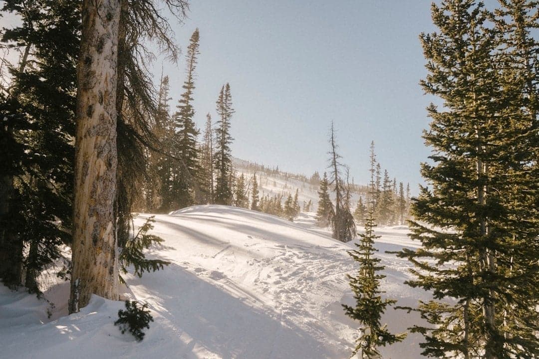
Winter Park is best known for skiing, but the Fraser Valley holds some of Colorado's most underrated trout water. The Fraser River runs 32 miles from Berthoud Pass to its confluence with the Colorado River near Granby, flowing directly through town and offering walk-from-downtown fishing. Within 45 minutes, you can reach the technical Williams Fork tailwater, the Colorado River's Gold Medal sections, and dozens of alpine lakes in the Indian Peaks and Never Summer Wilderness areas.
Grand County holds a significant share of Colorado's Gold Medal water—more than most other counties in the state. The upper Colorado River from the Fraser River confluence to Troublesome Creek (near Kremmling) carries that designation.
The area sees less pressure than Summit County or the Vail Valley, making it a strong choice for anglers who want quality fishing without fighting crowds.
Fraser Valley rivers follow Colorado's high-country pattern, with some variation due to reservoir releases:
| Season | Timing | Conditions | Best Bet |
|---|---|---|---|
| Early Season | May | Pre-runoff, water still low and clear | Fraser River, Williams Fork |
| Runoff | Late May-Jun | Freestones blown out, high muddy flows | Williams Fork tailwater only |
| Summer | Jul-Aug | Rivers clear, prime hatches, best conditions | All waters fishable |
| Fall | Sep-Oct | Stable flows, spawning activity, BWO hatches | Fraser River, Colorado River |
| Winter | Nov-Mar | Cold but fishable, midge hatches | Williams Fork, lower Fraser |
Key timing notes:
The Fraser is Winter Park's home water—a 32-mile tributary of the Colorado River starting high on the Continental Divide at Berthoud Pass (11,307 ft) and flowing northwest through Winter Park, Fraser, and Tabernash before joining the Colorado near Granby.
The Fraser is a meandering freestone with riffles, runs, tailouts, and deep pools. It's not dramatic pocket water—think gentle gradient through willowed meadows. Fish average 12-15 inches with some browns pushing 20 inches, though the best fish are typically found in the harder-to-reach canyon sections or on private water.
Track Fraser River flows at Tabernash for current conditions. Unlike tailwaters, freestone flows vary dramatically with snowmelt and irrigation diversions.
| CFS (Tabernash gauge) | Conditions |
|---|---|
| 50-100 | Low water, spooky fish, fine tippet essential, early/late season |
| 100-200 | Optimal - good wading, fish spread through runs and riffles |
| 200-350 | Higher but fishable, fish move to edges and slower water |
| 350-500 | Marginal, murky water likely, stick to edges |
| 500+ | Blown out, unfishable—typically late May through mid-June |
Critical note: The Fraser and Moffat Tunnel diversions significantly reduce flows. Peak runoff typically hits in early June, with flows sometimes exceeding 1,000 CFS at the combined Colorado/Fraser confluence at Windy Gap.
This is critical: Due to low flows from diversions, the Fraser can reach dangerous temperatures (65°F+) during July and August afternoons. Both the Fraser and upper Colorado regularly hit 65°F between 11:30 AM and 1 PM in summer.
Summer fishing protocol:
The Colorado River Headwaters Chapter of Trout Unlimited monitors temps closely and posts advisories.
Local etiquette: Due to high pressure in the Fraser Flats section between Fraser and Tabernash, locals ask anglers to voluntarily skip fishing this stretch on Tuesdays and Thursdays to give fish recovery time.
| Section | Regulations |
|---|---|
| Headwaters to St. Louis Creek confluence | Artificial flies and lures only, catch and release on rainbows |
| St. Louis Creek confluence to Colorado River | Bag/possession limit: 2 trout |
Berthoud Pass to Winter Park Resort (National Forest Land):
Winter Park to County Road 8 in Fraser:
Fraser Canyon / Tabernash Section (Best Public Water):
Local anglers consider the canyon sections near Tabernash the best fishing on the Fraser. Here's how to access it:
From the Winter Park Information Center, follow Highway 40 north 5.6 miles to County Road 83. Turn right for 0.4 miles, then left on County Road 84. Continue 0.75 miles to County Road 844 (also marked BLM 2751 / Strawberry Road) on the left. Follow Strawberry Road 1.4 miles to the parking area on the left.
From the parking area, hike downhill approximately 0.55 miles (about 15 minutes) to reach the river and canyon. Public water is available along the canyon and upstream a short distance.
Hazards: The railroad and private landowners guard their property closely along this section. Stay off railroad tracks and respect private property boundaries. Avoid the canyon during high runoff—the scramble down can be treacherous when wet.
Gold Medal Stretch (Private): A 3-mile Gold Medal section exists on Granby Ranch property north of the Fraser Canyon. This stretch is guided-only through outfitters with access agreements.
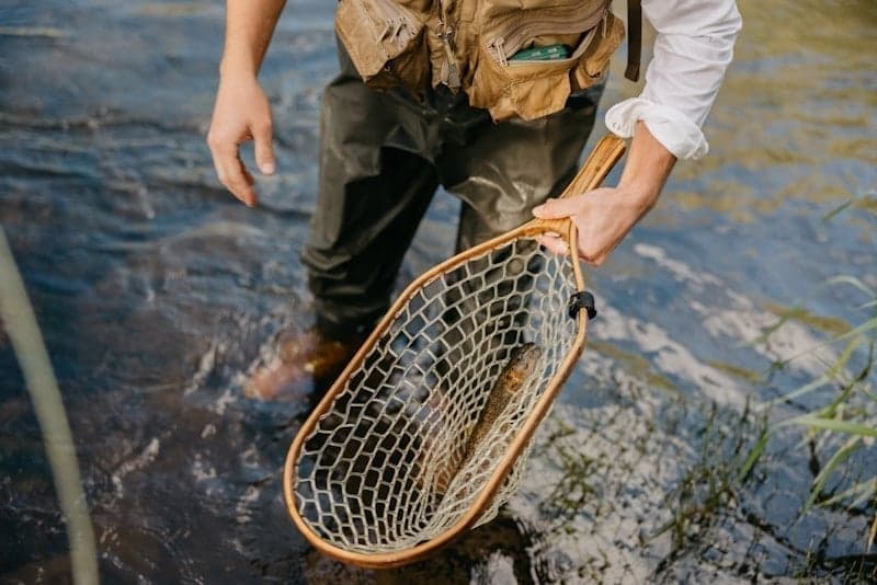
The Fraser Valley produces healthy wild rainbows, browns, and occasional cutthroat.
When the Fraser is marginal (blown out, too warm, or too crowded), several tributaries offer quality small-stream fishing.
St. Louis Creek is a 10+ mile fishable tributary joining the Fraser in the town of Fraser. It offers diverse water—beaver dams, fast riffles, willow-lined banks, and open meadow sections.
Access: From the Winter Park Information Center, turn right (west) on Highway 40 to Fraser. Turn left at the Wendy's stoplight, then right onto County Road 721, then left onto County Road 73. Continue to St. Louis Campground. The creek runs south of the road with several turnouts and small parking areas along the way.
Character: Averages about 6 feet wide, shallow in most places. Stealth is essential—these are spooky brook trout in clear water.
Gear: 3-4 weight rod. Hip waders or wading boots for crossing. Small dries (Adams, Royal Wulff, midges, gnats) in sizes 14-18. Grasshopper patterns in summer.
Regulations: Artificial flies and lures only. Catch and release on rainbows. 2 trout limit from St. Louis Creek to the Colorado.
Tip: Slowly wade upstream, practicing bow-and-arrow casts and short-line techniques. Expect eager brook trout. Bring bug spray—beaver ponds mean mosquito country.
Note: Dispersed camping is not allowed in the Fraser Experimental Forest.
The closest creek to downtown Winter Park. Cutthroat, brown, rainbow, and brook trout depending on elevation. Access via Vasquez Road from Winter Park.
Character: Intimate small-stream fishing. Most fish won't exceed 12 inches, but you can easily get into double digits on a single dry fly fished drag-free. Low pressure and tough access (some bushwhacking required) keep crowds away.
Tip: Fish straight up the creek, hitting spots along the way. Cover water at different elevations for a chance at all four trout species.
Regulations: 4 trout limit. South Fork of Upper Vasquez Creek and Lil' Vasquez Creek are fly/lure only; all cutthroat must be released.
Similar character to St. Louis and Vasquez. Worth exploring if you want to cover a lot of water.
The Williams Fork tailwater below Williams Fork Reservoir is one of Colorado's lesser-known quality fisheries—a technical tailwater with large trout and minimal crowds. It's about 45 minutes from Winter Park via Highway 40 to Parshall.
This small tailwater punches above its weight. Cold, clear releases from the reservoir support quality rainbow and brown trout that see far less pressure than waters near Denver. The catch? Limited public access and a hike to reach the water.
| CFS | Conditions |
|---|---|
| Under 100 | Very low, technical fishing, fish concentrated in pools |
| 100-200 | Good - manageable wading, fish spread out |
| 200-300 | Ideal - optimal fishing, good insect activity |
| 300-400 | Higher but fishable, stick to edges |
| 400+ | Difficult wading, less productive |
Note: Denver Water controls releases, which can be unpredictable. Check flows before making the drive.
Kemp/Breeze State Wildlife Area (Kemp Unit):
From Highway 40 in Parshall, turn left (south) on County Road 3. At 0.7 miles, turn right into the parking area (restrooms available). Follow the clearly marked trail approximately 1 mile to reach the Williams Fork River. About 2 miles of public water extends west toward the Colorado River confluence.
Trail conditions warning: The hike is exposed with no shade. In summer, it can be brutally hot—bring plenty of water and sun protection. Some sections of the boardwalk are in disrepair with collapsed sections, holes, and protruding nails. Watch your step. Mosquitoes can be heavy near the river.
Parshall/Confluence Access: Park in the town of Parshall off Highway 40. Wade across the Colorado River to reach the Williams Fork confluence. This approach requires crossing the Colorado, so plan for appropriate water levels—dangerous during runoff.
Important: Denver Water Board controls the land directly below the dam—that section is closed to fishing. Public access begins a short distance below the dam and extends to the Colorado River confluence.
The hike in filters out casual anglers, but those who make the walk find quality trout in clear water. The river features deep runs, pools, and pocket water lined with cottonwood trees.
Best times: The Williams Fork fishes well year-round, but is especially valuable during Fraser runoff (late May-June) when it's often the only fishable water in the area. Morning fishing is generally best; afternoon wind can make casting difficult.
Approach: Expect technical fishing—long leaders (12 feet), light tippet (5X-7X), fluorocarbon essential, and careful presentations. These fish see fewer anglers but are still educated.
Camping: Free camping available at Williams Fork Reservoir and Sugarloaf Campground (11 first-come, first-served sites along the river above the reservoir).
The Upper Colorado from the Fraser River confluence near Granby to the Kremmling area is Gold Medal water and one of the best float fishing destinations in the state.
This 20-mile stretch from Windy Gap Reservoir (at the Fraser confluence) to Troublesome Creek east of Kremmling is designated Gold Medal water. The regulations are flies and lures only, catch and release.
The river transitions from meandering meadow water near Granby through dramatic Byers Canyon, then opens into broader riffles and runs approaching Kremmling.
Byers Canyon offers 4 miles of deep, heavy-duty pocket water below Hot Sulphur Springs (20-30 minutes from Winter Park). This is the closest quality Colorado River fishing to Winter Park, but it requires effort to access.
Access Point #1 - Pioneer Park (East End): From Highway 40, at mile marker 9.3, turn right onto County Road 20, then left over the bridge. Pioneer Park offers camping, restrooms, and a picnic area with over 1 mile of river access on both sides, plus access to the east end of Byers Canyon. 2 trout limit.
Access Point #2 - West End of Byers Canyon: At mile marker 11.6 on Highway 40, parking area on the right. Steep, short trail to the river. You can walk along the canyon edge. Avoid during high water—the scramble is dangerous when wet.
Access Point #3 - Hot Sulphur Springs State Wildlife Area (Joe Gerrans Area): At mile marker 11.8, turn left at the east end of the bridge onto County Road 50. 2,300 acres on both sides of the river with camping, vault toilets, and a short hike down to the river from parking.
Canyon hazards: You have to scramble down about 100 feet of boulders to reach the water in the canyon proper. This is not for the mobility-challenged. The pocket water is deep and heavy—wading is challenging. But the effort filters out most anglers, and the fishing can be excellent.
Additional SWA units:
Pumphouse Recreation Area: The main access point for the best floating water. From Kremmling, head south on Highway 9, turn right on Trough Road, continue about 10 miles to Pumphouse. Boat ramp, parking, and camping available. This is the put-in for the famous Pumphouse-to-State Bridge float.
Radium Recreation Area: Below Pumphouse, similar character. Hot springs along the river banks make this a memorable destination. Five-mile float to the next takeout.
| CFS | Conditions |
|---|---|
| 800-1,500 | Relaxed float, some shallow spots |
| 1,500-3,300 | Ideal - good current, Class II rapids run clean |
| 3,300-5,500 | Faster, more technical floating |
| Over 5,500 | High water caution—bridge clearance issues |
Near Kremmling, the Colorado is wadeable at moderate flows. Pumphouse, Radium, and the islands near State Bridge offer walk-in access. But a drift boat or raft dramatically expands what you can reach. Many outfitters offer guided float trips.
For detailed float fishing information, see our Upper Colorado Summer Guide.
Grand County contains dozens of alpine lakes between 10,000-12,500 feet in the Arapaho National Forest, Indian Peaks Wilderness, Never Summer Wilderness, and Rocky Mountain National Park. These high-country waters offer solitude and willing fish.
Meadow Creek Reservoir: 50 acres, 30-45 minutes from Winter Park. Non-motorized boats only. Take County Road 83 east of Tabernash, fork left onto County Road 84. First-come, first-served camping. Day pass ($5) or multi-day pass required.
Monarch Lake: 150 acres in the Arapaho National Recreation Area. Non-motorized boats permitted. Trailhead for Indian Peaks Wilderness. Good populations of rainbows and browns.
Lake Granby: One of Colorado's largest reservoirs. Rainbow trout, brown trout, kokanee salmon, and lake trout. Full-service marina access.
Popular alpine destinations include Lake Evelyn, Horseshoe Lake, Lake Dorothy, Columbine Lake, Strawberry Lake, St. Louis Lake, King Lake, Betty and Bob Lakes, and Lost Lake. Most require hiking—some require overnight backpacking trips.
Best Timing: July through September for the highest lakes. Early June through mid-October for more accessible options.
Species: Brook, rainbow, cutthroat, and brown trout depending on the lake. Four-trout limit with standard Colorado regulations.
Spring (May-Early June):
Summer (Late June-August):
Fall (September-October):
Technical water requires careful pattern selection:
Keep it simple on the tributaries:
Devil's Thumb Ranch is an Orvis-Endorsed Lodge in Tabernash offering private water access on 4 miles of Ranch Creek and 1 mile of the Fraser River.
Ranch Creek: A headwaters stream flowing through the property. Three distinct sections offer different character—from willow-lined beaver ponds to open meadow water. Browns, brookies, rainbows, and occasional cutthroat. Perfect for a 2-3 weight rod.
Section 1 is available for non-guided fishing by lodge guests ($75 private water rod fee). All other private water requires a guide.
Two Stocked Ponds: Good for beginners or families.
Season: March 1 through October 31, weather dependent. Mid-June through September is prime.
The ranch operates a full fly shop with equipment rental and expert guides for all skill levels.
Winter Park's local fly shop offering personalized trips on the Fraser, Colorado, and mountain streams including Troublesome Creek.
Guided fly fishing trips and lessons for all experience levels. They fish the Colorado and Fraser Rivers plus private ranch water.
Full-service Orvis shop at the ranch with equipment rental, instruction, and guided access to private water.
Pro tip: Call ahead for current conditions. Local shops know when the Fraser is running too warm, when Williams Fork releases are favorable, and where fish are holding.
| Water | Key Regulations |
|---|---|
| Fraser River (upper) | Flies/lures only, catch and release on rainbows |
| Fraser River (lower) | 2 trout limit |
| Williams Fork | Flies/lures only, catch and release |
| Colorado River (Gold Medal) | Flies/lures only, catch and release |
| Byers Canyon area | 2 trout limit |
| St. Louis Creek | Flies/lures only, catch and release on rainbows, 2 trout limit below |
| Vasquez Creek | 4 trout limit (South Fork: flies/lures only, release all cutthroat) |
| Alpine Lakes | Standard CO regulations, 4 trout limit |
Always verify current regulations with Colorado Parks & Wildlife before your trip.
Winter Park sits at 9,000 feet. The Fraser headwaters near Berthoud Pass exceed 11,000 feet. Acclimate before strenuous hiking or wading. Symptoms of altitude sickness can impair judgment on the water.
This bears repeating: Both the Fraser and Colorado can hit dangerous temperatures (65°F+) by midday in summer. Fish early, stop by noon, and skip hot afternoons entirely. Stressed fish have higher mortality even when released properly.
All area rivers run cold in spring and fall. The Williams Fork tailwater stays frigid year-round. Hypothermia is possible with extended immersion even in summer.
Summer afternoons bring lightning, especially on exposed ridges and alpine lakes. Plan to be off high-country water by early afternoon. This aligns well with the water temperature guidance—another reason to fish mornings.
Late May through mid-June brings dangerous high water on freestone streams. The Williams Fork tailwater remains fishable, but the Fraser and Colorado can run at several times normal volume with limited visibility. Wading is dangerous; stick to the Williams Fork or wait it out.
The mile-long trail to the Williams Fork is exposed with no shade, collapsed boardwalk sections, holes, and protruding nails. Bring water, wear sun protection, and watch your footing.
Reaching the water in Byers Canyon requires scrambling down 100 feet of boulders. This is not for everyone. Avoid when wet.
Plan your Winter Park fishing with real-time flow data:
Track all Winter Park area rivers on RiverReports:
Download the RiverReports app for mobile access while on the water.
Weekly flow updates and fishing intel.
© 2026 RiverReports, Inc.