Quick Reference
| What | When | Key Numbers |
|---|
| Skwala hatch (Bitterroot) | Mid-March to late April | 20"+ fish possible; target 800-1,200 CFS |
| Salmonfly hatch (Rock Creek) | Late May to mid-June | Memorial Day weekend peak; hatch moves 3-5 mi/day upstream |
| Prime dry fly season | June through September | Golden stones, caddis, PMDs, hoppers |
| Fall fishing | September to November | BWOs, October Caddis, streamers; fewer crowds |
| Typical fish | Year-round | 12-14" average; 16"+ good day; 20"+ exceptional |
| Guided trips | Book by March for peak | $525-750/day for 1-2 anglers |
| Fly shop | The Missoulian Angler | (406) 728-7766, 401 S Higgins Ave |
Flow~1,100 CFS near Darby (USGS 12344000)—continued steep drop from 1,410 CFS on June 16; flows approaching ideal summer levels; wading excellent in upper stretches; floating outstanding valley-wide
Trenddropping
Clarityexcellent; upper sections (Hamilton/Darby) 4+ ft visibility; middle and lower stretches clear; West Fork below Painted Rocks Reservoir glass-clear
Temp57-60°F near Darby (USGS); warming to low 60s midday in lower stretches; ideal multi-hatch window 9am-6pm
Golden Stones #6-8 (Plan B GoldenFluttering Stone GoldenRastaman Golden—dominant hatch valley-wide; best 9am-5pm along rocky banks)PMDs #16-18 (peak emergence; outstanding mid-morning through early afternoon)
Flow~800 CFS near Clinton (USGS 12334510)—continued drop from 917 CFS on June 17; at prime wade-fishing levels; getting a bit bony for floating in some spots
Trenddropping
Clarityexcellent; 4+ ft visibility in upper and middle reaches; improving throughout
Temp53-55°F near Clinton (USGS)—ideal for multi-hatch activity; golden stones, mayflies, and caddis all firing
Golden Stone dries #6-10 (Plan B GoldenFluttering Stone GoldenRastaman Golden—dominant big bug valley-wide)Chubbies #6-14 (pink/yellow/black—top dry-dropper top fly)
Flow~2,500 CFS near Bonner (USGS 12340000)—continued steady drop from 3,060 CFS on June 14; prime range for float fishing and bank wading; fish spread through runs and riffles
Trenddropping
Claritygood to excellent; main channel showing 3+ ft visibility; back eddies and margins excellent clarity
Temp56-58°F near Bonner (USGS)—ideal for salmonfly and multi-hatch activity; fish feeding actively all day
Salmonfly dries #4-6 (True Salmon FlySuper Gee Salmon Fly—hatch still strong on middle and upper river; big bugs moving upstream)Golden Stone dries #6-8 (Plan B GoldenFluttering Stone Golden—building rapidly behind salmonflies)
Flow~3,600 CFS above Missoula (USGS 12340500); ~7,200 CFS below Missoula (USGS 12353000)—continued steady drop; approaching prime summer levels
Trenddropping
Claritygood and improving above Missoula; fair to good below; Kelly Island braids and side channels fishing well with solid visibility; clarity improving daily throughout
Temp60-62°F above Missoula (USGS)—warm enough for active multi-hatch feeding; monitor afternoon temps and shift to morning/evening if above 65°F
Salmonfly dries #4-6 (True Salmon FlySuper Gee—active from Rock Creek confluence through Alberton Gorge)Golden Stone dries #6-8 (Plan B GoldenFluttering Stone Golden—arriving in force)
🎣 TACTICS RIGHT NOWDry FlyDry fly fishing is at peak across the Missoula valley—all four rivers fishing well on top. Blackfoot: salmonfly hatch still strong on middle and upper river at ~2500 CFS; golden stones building rapidly behind; fish salmonfly dries #4-6 and golden stones #6-8 along rocky banks and boulder gardens from Johnsrud to Bonner; this is peak big-dry action with fish looking up tight to the banks all day. Rock Creek: ~800 CFS—golden stones dominantsalmonflies finishedGreen Drakes strong on overcast daysPMDs at peak mid-morningYellow Sallies steadycaddis excellent evenings; Chubbies #6-14 the top dry-dropper top fly; wade-fishing paradise. Bitterroot: golden stones along rocky banks 9am-5pmPMDs at peak mid-morningYellow Sallies strong and increasingGreen Drakes on overcast afternoons; the middle river (Hamilton-Stevensville) is prime at ~1100 CFS near Darby; West Fork below Painted Rocks remains the most reliable technical dry fly water. Clark Fork: salmonflies pushing through Alberton Gorge; dry-dropper along the banks in Kelly Island braids and the town stretch productive; clarity improving daily.
NymphNymphing is a secondary approach as dry fly fishing dominates—but it's still the most consistent producer in faster water and before hatches fire each morning. Rock Creek: Pat's Rubber Legs #6-8TJ Hookers #6-8Prince Nymphs #12-16Pheasant Tails #12-16Perdigons #14-18 through pocket water and riffles; ideal as a dropper under a Chubby or Golden Stone. Blackfoot: Pat's Rubber Legs #6-8Double Bead Stones #6-8TJ Hookers under dries in deeper runs and early mornings before the hatch fires. Clark Fork: stonefly nymphs (Pat's Rubber LegsDouble Bead StonesFront St. Stones #6-8)Zirdles #12-16 through Kelly Island braids and deeper runs. Bitterroot: Perdigons #14-16Pheasant Tails #14-16TJ Hookers #8-12 under Chubbies in the Hamilton/Darby corridor; Joe's Mini Crayfish Jig #6 swung along rocky bottom still producing big browns.
StreamerStreamer fishing takes a back seat to the outstanding dry fly opportunities right nowbut remains productive for targeting larger fish. Clark Fork: dead-drift Sparkle MinnowsKreelex Minnowsand Woolly Buggers through Kelly Island braids—particularly effective in the early morning before hatches fire and in the evening. Blackfoot: Halloween Buggers #4-6Sparkle Minnow Sculpins #4-6 through deeper pools between dry fly sessions. Rock Creek: Woolly BuggersSculpzillasSparkle Minnows tight to structure in the lower 14 miles (Dalles to mouth) for the biggest browns. Bitterroot: Joe's Mini Crayfish Jig #6 along rocky bottom for big browns; flashy streamers through deeper pockets between hatch windows.
FORECASTThe Missoula valley is in peak late-June form—all four rivers are fishing excellently with flows continuing their steady descent toward ideal summer levels. The Blackfoot's salmonfly hatch remains strong on the middle and upper river at ~2,500 CFS with golden stones building rapidly behind—this is multi-hatch paradise with Green Drakes, PMDs, and caddis adding to the action. Rock Creek at ~800 CFS is in classic wade-fishing form with golden stones dominant, PMDs at peak, and caddis strong in the evenings; salmonflies are finished. The Bitterroot at ~1,100 CFS near Darby has hit its stride—golden stones dominant, PMDs peaking, Yellow Sallies increasing—the Hamilton to Stevensville stretch is in prime shape for both wading and floating. The Clark Fork continues improving daily with clarity recovered from last week's bump and salmonflies pushing through the Alberton Gorge. The next 5-7 days should see flows continue dropping, with golden stones transitioning to the dominant big bug across all rivers; PMDs, Yellow Sallies, and caddis will keep building. Watch afternoon water temps on all rivers—carry a thermometer and shift to early/late sessions if temps push above 65°F; the Clark Fork is most sensitive. Weather forecast calls for mostly clear skies and highs in the low 80s—ideal conditions. CAUTION: Fresh log hazard in lower Fire Ring-Elkhorn section on Rock Creek. Debris at Main Street Diversion on the Bitterroot—call Grizzly Hackle (406-721-8996) or Missoulian Angler (406-728-7766) for current status. FWP proposed floating closure on the lower Blackfoot (Weigh Station FAS to I-90)—verify at fwp.mt.gov.
Overview
Missoula sits at the confluence of five valleys and four productive trout rivers. With over 340 miles of fishable water within an hour's drive and more than 300 working guides, the town has built its identity around fly fishing. The dry fly season runs from March through November—one of the longest in the West.
The four primary rivers each have distinct personalities:
- Bitterroot River: Wakes up first in spring. Famous for the Skwala hatch starting mid-March. Over 80 miles of floatable water with 13 access sites.
- Blackfoot River: The "A River Runs Through It" river. Best June through October. Native cutthroat, rainbows, browns, and bull trout in a scenic canyon setting.
- Rock Creek: Wade fishing paradise with prolific salmonfly hatches. Over 50 miles of public access through National Forest land.
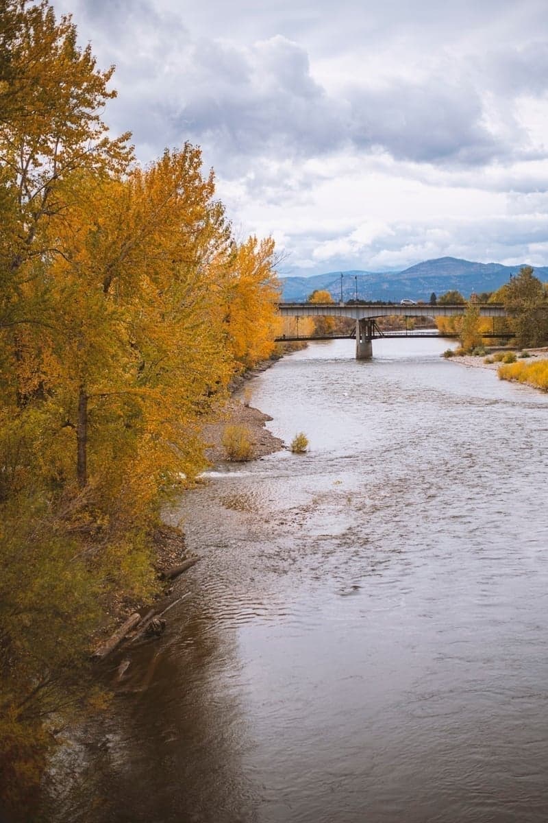
- Clark Fork River: Montana's largest river by volume. Runs through downtown Missoula. Excellent fall fishing for big rainbows.
The practical advantage of fishing Missoula: if one river isn't fishing well, you've got three backups. If the Blackfoot is slow, hit the Bitterroot. If runoff has the Bitterroot off, head to Rock Creek. This flexibility makes trip planning more forgiving than single-river destinations.
If You Only Have One Day
March–April: Float the Bitterroot from Bell Crossing to Tucker Crossing (5 miles, half-day). The Skwala hatch concentrates in this middle section. Fish the banks with olive Stimulators in #6-8. This is your best shot at a 20-inch brown on a dry fly all year.
May: Tough month due to runoff. Wade the Clark Fork town stretch at Kelly Island (walk from Spurgin Road FAS). The braided channels fish well even when main rivers are blown out. Target back eddies with streamers.
June: Float Rock Creek from Harry's Flat to the mouth (before July 1 closure). Time your trip to intercept the salmonfly hatch—it moves upstream 3-5 miles per day. Call Rock Creek Mercantile the day before to confirm where the hatch is.
July–August: Float the Blackfoot from Johnsrud to Bonner (10 miles, full day). Work hopper-droppers tight to the banks. The boulder gardens and deep pools hold rainbows and browns in the 12-16 inch range, with bigger fish in the deeper holes below Johnsrud.
September–October: Float the lower Clark Fork from Forest Grove to Dry Creek (14 miles, full day). This is the least-pressured quality water near Missoula. Tricos in the morning, BWOs in the afternoon. The rainbows here average larger than the other rivers—14-16 inches typical, with 18-inch fish not uncommon.
What to Expect: Fish Size
Set realistic expectations. These are wild trout rivers, not tailwaters stocked with trophy fish.
| River | Typical Fish | Good Day | Exceptional |
|---|
| Bitterroot | 12-14" | 16"+ | 20"+ (Skwala season) |
| Blackfoot | 10-14" | 15"+ cutthroat or rainbow | 18"+ (lower river) |
| Rock Creek | 10-14" | 15"+ | 18"+ brown (fall spawners) |
| Clark Fork | 12-15" | 16"+ | 18-20"+ (lower river rainbows) |
When trophy fish are most likely:
- Skwala hatch (March-April): Big browns come up for the first major dry fly meal of the year. Fish over 20" are caught every season on the Bitterroot.
- Fall streamer season (October-November): Pre-spawn browns become aggressive. 4-7 pound fish are possible with big streamers in the deeper runs.
- Lower Clark Fork fall: The rainbows here fight harder and average larger than the other rivers. Patient anglers fishing BWO hatches can find 18-inch fish.
Seasonal Calendar
March–April: Skwala Season
The Bitterroot comes alive first. As Missoula's southern-most river, it warms earlier than the others, and Skwala stoneflies start emerging mid-March. This hatch was once a local secret but now draws anglers from across the country. The bugs are large (#6-8), the fish are hungry after winter, and some of the biggest browns of the year come to the surface.
Where to fish: The middle Bitterroot from Hamilton to Stevensville fishes best. Water temperatures in the upper river stay cold longer.
What to throw: Olive Stimulators, Skwala patterns in #6-8. Fish the banks. Trout will move considerable distances for these big bugs.
The Clark Fork and Rock Creek also see early mayfly activity—March Browns and Blue-winged Olives—as April approaches. These smaller patterns (#14-18) work well on overcast days.
May: Runoff and Transition
May is the trickiest month. Snowmelt pushes rivers high and off-color. The Bitterroot typically blows out late April and clears by late May. Rock Creek runs high and fast—wading is difficult but salmonflies start showing in the lower reaches by month's end.
Best bet: Fish the mornings before flows spike. Target slower water and back eddies. Mother's Day caddis hatches can be excellent on the Clark Fork if timing aligns with clearer water.
June: Prime Time Begins
June delivers the goods. Salmonflies hatch on Rock Creek (usually starting Memorial Day weekend), followed by golden stoneflies, caddis, and Green Drakes. This is when Missoula earns its reputation.
Rock Creek salmonflies: The hatch starts in the lower reaches and moves upstream daily. By mid-June, it reaches the upper river. The spectacle is real—afternoons can see clouds of bugs in the air. But don't sleep on golden stones and Green Drakes, which often produce better fishing since everyone else is chucking orange foam.
Blackfoot stoneflies: Golden stoneflies push up the Blackfoot in June. The river from Johnsrud to Russell Gates fishes well for float anglers.
Flow note: Rivers are dropping but still have good current. Wade fishing becomes more accessible as the month progresses. Check flows—ideal wading on Rock Creek is below 400 CFS.
July–August: Dry Fly Heaven
This is beginner-friendly season. Rivers settle into summer flows. Wading is easy. Hatches are consistent.
Key hatches: PMDs (Pale Morning Duns) in the mornings, caddis in the evenings, Yellow Sallies throughout. By August, hoppers take over. Fish the banks with attractor dries and hopper-dropper rigs.
The Blackfoot fishes beautifully through this period. Float from Johnsrud to the Clark Fork confluence and work every boulder and seam. The Bitterroot's lower sections from Florence to the mouth produce reliable dry fly action.
Heat warning: August afternoons can push water temps above 65°F. Fish early mornings and evenings. Carry a thermometer—stop fishing if temps hit 68°F to protect stressed trout.
September–October: Fall Rewards
The shoulder season offers the best combination of quality fishing and solitude. Summer crowds disappear. Trout feed aggressively before winter.
Lower Clark Fork: This is when the "Lower" shines. From Alberton Gorge downstream, the river widens into long flats and deep pools. BWOs hatch on cloudy afternoons. Trico spinners bring fish up in the mornings. Big rainbows—larger on average than other local rivers—cruise these slower stretches.
October Caddis: The Blackfoot and Rock Creek both see solid October Caddis hatches. Trout crush these big bugs (#8-10) with violent strikes.
Streamers: Brown trout become aggressive as spawn approaches. Strip Woolly Buggers and Sculpzillas through the deeper runs. This is your best shot at a 20-inch-plus brown.
November: Last Call
Rivers remain open through November 30. Nymphing with Zebra Midges and small BWO patterns produces fish. Streamer fishing stays productive. Expect cold mornings but peaceful days on the water.
The Rivers in Detail
Bitterroot River
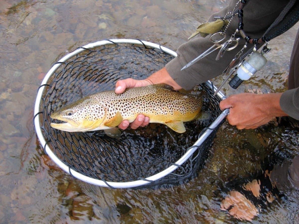
Character: 80+ miles of freestone river flowing north from the Idaho border to Missoula. The upper river near Darby and Connor holds cutthroat in a more intimate, tree-lined setting. The middle river (Hamilton to Stevensville) widens with classic riffle-pool structure—this is prime brown trout water. The lower river below Florence features braided channels and log-studded banks where big fish hide.
Fish populations: FWP surveys estimate around 700-1,000 fish per mile, with rainbows and browns averaging 800-900 per mile in the upper sections. Most fish run 12-14 inches; 16-inch fish are a good catch; trout over 20 inches are landed yearly, with fish to 23 inches documented. This river sees over 100,000 angler days annually—the highest pressure in FWP Region 2—yet fish remain surprisingly willing.
Float Sections:
| Section | Miles | Time | Notes |
|---|
| Hannon Memorial to Darby | 4 | 2-3 hrs | Upper river; cutthroat water; low water issues late summer |
| Darby to Wally Crawford | 6.5 | 3-4 hrs | Scenic canyon stretch |
| Wally Crawford to Angler's Roost | 9 | 4-5 hrs | Transitions to brown trout water |
| Bell Crossing to Tucker Crossing | 5 | 2-3 hrs | Prime Skwala water; best March-April float |
| Woodside to Tucker West | 6 | 3-4 hrs | Catch-and-release section; concentrated fish |
| Stevensville to Florence | 10.5 | 5-6 hrs | Through wildlife refuges; reliable summer fishing |
| Florence to Maclay (Lolo) | 13 | 6-7 hrs | Long day; braided channels; big fish in logjams |
Where to fish: The middle river from Hamilton to Stevensville holds the best brown trout. Target the outside bends where logs and debris collect—browns stack up in these spots, especially during Skwala season. The braided section below Florence has fewer fish per mile but more 20-inch fish hiding in the woody debris. Work your flies tight to downed timber.
Access: Montana FWP maintains 13 fishing access sites. Highway 93 parallels nearly the entire river. Key sites from south to north:
- Hannon Memorial (Darby area): Hand-launch with camping; upper cutthroat water
- Poker Joe, Bell Crossing (Hamilton area): Boat ramps; prime Skwala float starts here
- Tucker Crossing, Woodside Bridge (Corvallis area): Wade and float; catch-and-release section
- Florence Bridge (Florence): Popular takeout; wildlife refuge access
- Maclay Bridge (near Missoula): Final takeout before Clark Fork confluence
Catch-and-release section: The stretch from Florence Bridge upstream to Woodside Bridge is catch-and-release, artificial only. This regulation has concentrated quality fish—expect better average size here.
Late summer warning: The section between Corvallis and Stevensville can become too shallow to float during low-water years due to irrigation withdrawals. Below Stevensville, the river picks up tributary flow and floats fine.
Best for: Spring Skwalas (March-April), summer dry fly fishing, accessible wading
Character: This is the river Norman Maclean immortalized. From its headwaters near the Continental Divide (Lincoln/Rogers Pass area), it flows 130 miles through forested canyons and rolling ranch country to meet the Clark Fork at Bonner, just east of Missoula. The lower Blackfoot features ledge-rock drops, boulder gardens, and technical Class II-III water during spring flows. Plunge pools the size of hot tubs, giant eddies, and long seams of fast water define this river's character.
Fish species: Native westslope cutthroat (catch-and-release required), rainbows, browns, brook trout in tributaries, and bull trout (no targeting allowed). Expect cutthroat and rainbows in the 10-14 inch range; 15-inch fish are a good catch. The lower river below Johnsrud holds true monsters—browns and rainbows to 18 inches lurk in the deep pools. Decades of restoration work have rebuilt populations devastated by mining contamination in the upper river. Biologists report increasing numbers of larger rainbows in the lower and middle stretches.
Float Sections:
| Section | Miles | Time | Difficulty | Notes |
|---|
| Russell Gates to Roundup | 10 | 4-5 hrs | Class II (III in runoff) | Scenic canyon; good numbers of fish |
| Roundup to Whitaker Bridge | 10 | 4-5 hrs | Class I-II | 6 miles of quiet water after Ninemile Prairie |
| Whitaker to Johnsrud | 6 | 2-3 hrs | Class II+ | Thibodeau Rapids; most productive stretch |
| Johnsrud to Bonner (Weigh Station) | 10-11.5 | 4-6 hrs | Class I | Wide runs; biggest fish; follows Hwy 200 |
Where to fish: The stretch from Johnsrud to Bonner is the most productive. Wide, deep runs interspersed with riffly boulder gardens hold higher densities of rainbows and browns, including the river's largest fish. Work the deep pools below Johnsrud with nymphs fished deep—the big ones sit at the bottom. Above Johnsrud, focus on the plunge pools and eddies, which can hold multiple fish. The upper river near Lincoln offers decent wade fishing in lower-gradient water—work the long pools and glides with dry-droppers.
Access: The Blackfoot River Recreation Corridor runs from Russell Gates downstream to Johnsrud Park. Key access points:
- Russell Gates FAS (12 miles east of Bonner): 11 campsites, boat ramp, good wade access; canyon stretch begins here
- Roundup Bridge: Class III rapid at the bridge; marks the start of more technical water
- Whitaker Bridge: Day-use only, walk-in access, good wading; Thibodeau Rapids just downstream
- Johnsrud Park FAS (8 miles east of Bonner): The "lower Blackfoot" starting point; boat ramp, toilets; biggest fish downstream of here
Floating notes: Russell Gates to Johnsrud runs about 16 miles through the most scenic and productive water. Expect Class II water with Thibodeau Rapids (Class III at certain flows) below Whitaker Bridge. The Roundup to Johnsrud stretch requires experienced rowing. Below Johnsrud, it's mostly mellow water along Highway 200 with one Class I rapid near Marco Flats.
Camping restrictions: Within the Recreation Corridor, camping is prohibited except at eight designated float-in sites: River Junction, Bear Creek Flats, Clearwater, Ninemile Prairie, Corrick's River Bend, Ponderosa Flats, Goose Rock, and Clark's Cliff. Reserve through Reserve America (1-855-922-6768)—reservations open in spring and fill quickly for peak season. Fire pans, food storage containers, and portable toilets required. Groups limited to 10 people. No glass containers. Food storage boxes provided at each site.
Best for: Scenic floats, June stoneflies, fall caddis, native cutthroat
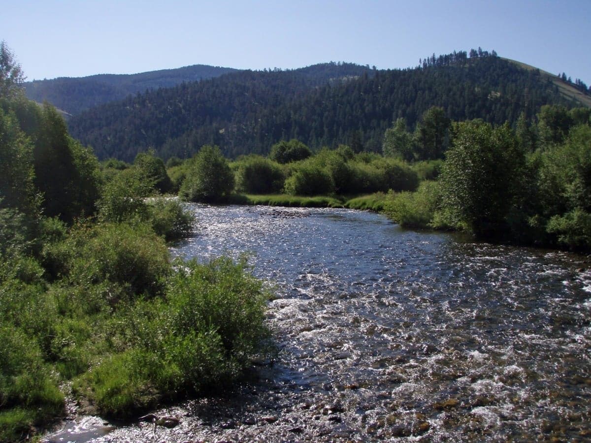
Rock Creek
Character: Born in the Pintlar Mountains near Philipsburg, Rock Creek flows 52 miles to meet the Clark Fork near Clinton. This is a wade fisher's river—medium-sized, accessible along its length, with prolific bug life. Rock Creek Road (potholed gravel that narrows to single lane in places) parallels the river through National Forest land. One of the highest trout-per-mile counts in the state.
Fish species: Rainbow and brown trout, with browns dominating the lower 14 miles from Dalles to the Clark Fork. Cutthroat and brook trout in the upper reaches and tributaries. Expect cutthroat 10-14", rainbows 10-16", and browns 12-18". Fish get larger as you move downstream—the lower river holds the biggest browns. A "Grand Slam" day (catching cutthroat, rainbow, brown, brook, and bull trout) is genuinely possible here.
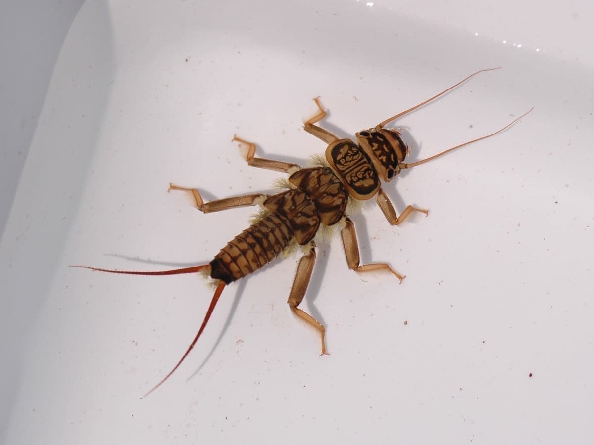
The salmonfly hatch: Rock Creek's salmonfly emergence typically begins Memorial Day weekend in the lower river and moves upstream 3-5 miles per day over two weeks. Afternoons can see clouds of bugs in the air. But wading is tough during this period—flows are high, and cleats plus a wading staff are essential. Golden stones and Green Drakes follow and often produce better fishing since everyone else is focused on salmonflies.
Where to fish: The lower 14 miles (Dalles to the mouth) holds the biggest browns. Work the deeper pools and runs with streamers, especially in fall when spawning fish move up from the Clark Fork—13-18 inch fish are possible. The braided sections near Valley of the Moon and Norton Campground offer excellent dry fly water during summer. The upper river above Dalles has more cutthroat in a smaller stream setting.
Access: Over 50 miles of public access through Lolo National Forest.
| Location | Mile | Notes |
|---|
| Clinton FAS | 0 | Confluence with Clark Fork, takeout for floats |
| Tamarack | 4 | Popular put-in/take-out, watch for sweepers |
| Solomon FAS | 6 | Parking, foot path to creek |
| Sawmill FAS | 8 | Island fishing, Brewster Creek enters nearby |
| Norton Campground | 10 | Back of campground, foot trail, awesome run to the north |
| Valley of the Moon | 12 | Local favorite - excellent braided water for wading |
| Mile 13 | 13 | Crude launch for floating to Tamarack |
| Harry's Flat | 16 | Lower river, big brown trout water |
| Dalles Campground | 20 | Upper quality water begins; cutthroat transition |
Road conditions: First 12 miles are paved with designated access among private land. At Norton (mile 12), the road turns to gravel, narrows, and gets rough. Upper sections are single-lane with potholes—allow extra time and consider vehicle clearance
Critical regulation: Floating is prohibited July 1 through November 30. You can float before July 1, but after that, it's wade-only. This regulation keeps pressure low through the best summer months—take advantage of it.
Fishing regulations (Western District):
- December through May: Catch-and-release for all trout, artificial lures only
- Season: Daily limit of 3 brown trout; rainbows and cutthroat are catch-and-release
Local tip: The Rock Creek Mercantile, less than a mile down Rock Creek Road, sells flies, tackle, and Montana licenses. Open 7 AM to 7 PM during summer. Call them the day before your trip—they'll tell you exactly where the salmonfly hatch is and what's working.
Best for: Wade fishing, salmonfly hatch, solitude after July 1
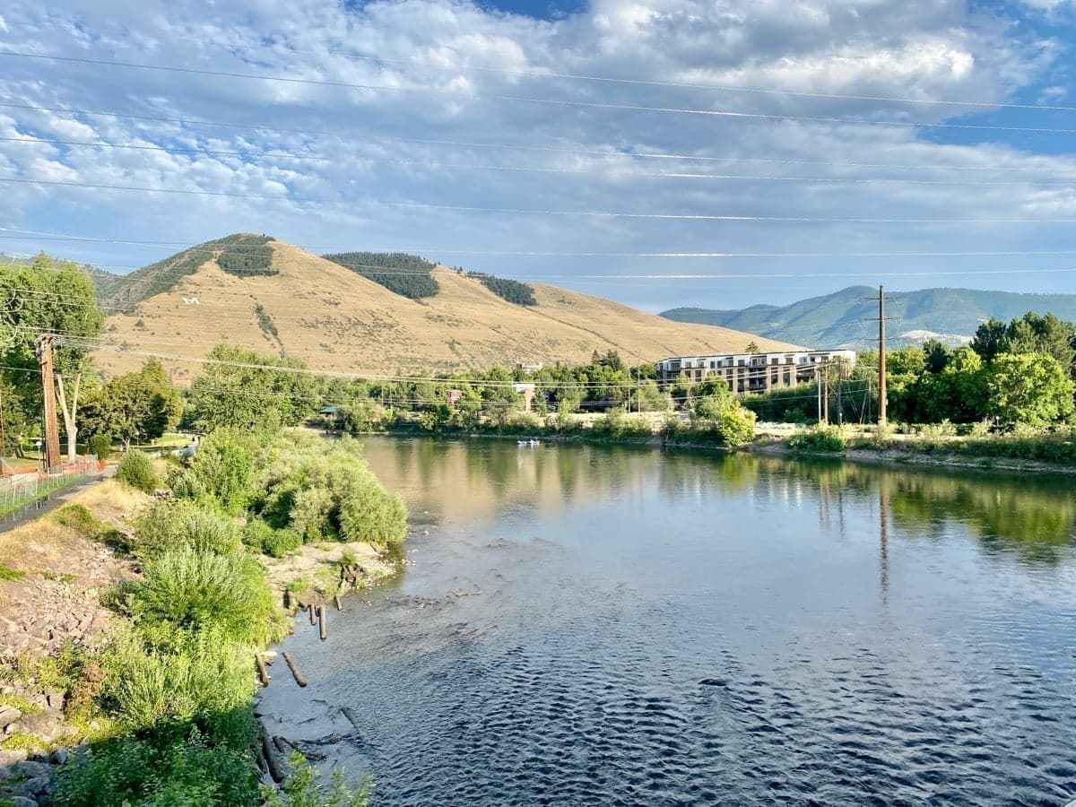
Clark Fork River
Character: Montana's largest river by volume. From its headwaters near Butte, it flows 310 miles to Lake Pend Oreille in Idaho, gathering the Blackfoot, Bitterroot, and Rock Creek along the way. The character changes dramatically: the upper Clark Fork above Missoula is a small meadow stream dominated by brown trout. Below Missoula, it becomes a big, powerful river with deep pools, long riffles, and serious whitewater in the Alberton Gorge.
Fish populations: Browns dominate the upper river (90%+ in some sections). Below Rock Creek's confluence, rainbows become more common. Expect 12-15 inch fish as typical; 16-inch fish are a good catch. The lower Clark Fork, from the Alberton Gorge to St. Regis, holds larger-than-average rainbows—14-16 inches typical, with 18-20 inch fish not uncommon. These fish fight disproportionately hard for their size.
Float Sections:
| Section | Miles | Time | Difficulty | Notes |
|---|
| Kelly Island to Kona Bridge | 4 | 2 hrs | Class I | No technical water; town stretch |
| Kelly Island to Harper's Bridge | 10 | Full day | Class I | Extended town float |
| Harper's Bridge to Huson | 12-13 | Full day | Class I-II | Good fishing; some technical water |
| Huson to Petty Creek | 9 | 4-5 hrs | Class I | Non-technical; cement ramp takeout |
| Petty Creek to Cyr | 6 | 3 hrs | Class II | Leads into Alberton Gorge |
| Cyr to Tarkio | 10 | 4-5 hrs | Class III-IV | Alberton Gorge; whitewater experience required |
| Tarkio to Forest Grove | 5-6 | 2-3 hrs | Class II | Shaded; good summer option |
| Forest Grove to Superior | 11 | Full day | Class I-II | Best fall fishing; big rainbows |
| Superior to Dry Creek | 3 | 1-2 hrs | Class I | Short add-on |
| Dry Creek to St. Regis | 10 | Full day | Class I-II | Slower flats; remote |
The "Town Stretch" (Kelly Island): The Clark Fork braids through downtown Missoula, and these side channels offer some of the best wade fishing on the entire river. Access via Spurgin Road FAS. Pick apart the small channels for rising fish, or work the big open water. The confluence with the Bitterroot creates excellent structure. Many locals overlook this as wade fishing water—don't make that mistake.
Where to fish:
- Kelly Island area: Wade the braided channels; look for rising fish in the side channels during morning and evening hatches
- Lower river (Forest Grove to St. Regis): This is the sleeper water. Long, shallow glides interspersed with deep holes along canyon walls. Less pressure, bigger rainbows. September-October is prime—Tricos in the morning, BWOs in the afternoon, mahogany duns as water cools.
Access: Numerous access points along I-90. Key sites:
- Kelly Island/Spurgin Road FAS (Missoula): Walk-in wade access; boat ramp; popular for good reason
- Kona Bridge: Good float takeout; some wade access
- Petty Creek Bridge: Good cement ramp; marks transition to bigger water
- Cyr: Alberton Gorge put-in; commit to whitewater from here
- Tarkio: Gorge takeout; avoids worst rapids if you put in at Petty Creek
- Forest Grove: Below the gorge; start of best fall fishing water
- Superior (Big Eddy), Dry Creek: Lower river access points
Alberton Gorge Rapids:
| Rapid | Class | Notes |
|---|
| Cliffside | III | Upper Gorge - biggest waves at lower flows |
| Triple Bridges | III | |
| Boateater | II-III | Chaotic wave-hole |
| Tumbleweed | III | |
| Fang | III-IV | The big one - can flip rafts, best surfing above 2,500 CFS |
Put-in at Cyr Bridge (Cyr exit off I-90). Upper Gorge is a step easier than Lower Gorge. Can paddle separately or combine. May through September for rafting. Unless you're an experienced whitewater boater, put in below the gorge at Forest Grove or take out at Tarkio.
Best for: In-town wading, fall dry fly fishing, big rainbows on the lower river
Fly Box Essentials
Dries
| Pattern | Sizes | When |
|---|
| Skwala/Olive Stimulator | #6-8 | March-April |
| Salmonfly patterns (Sofa Pillow, Chubby) | #4-8 | Late May-June |
| Golden Stonefly | #6-10 | June-July |
| Elk Hair Caddis | #14-18 | May-October |
| PMD patterns | #16-18 | June-August |
| Parachute Adams | #14-20 | Year-round |
| Schroeder's Hopper | #8-12 | July-September |
| BWO patterns | #18-22 | March-April, September-November |
| October Caddis | #8-10 | September-October |
Nymphs
| Pattern | Sizes | Notes |
|---|
| Pat's Rubberlegs | #6-10 | Year-round stonefly |
| Pheasant Tail | #14-18 | Mayfly standard |
| Hare's Ear | #12-16 | All-purpose |
| Prince Nymph | #12-16 | Attractor |
| Zebra Midge | #18-22 | Year-round |
| RS2 | #18-22 | BWO emerger |
| Lightning Bug | #14-18 | Local favorite |
Streamers
| Pattern | Sizes | When |
|---|
| Woolly Bugger (olive, black) | #6-10 | Year-round |
| Sculpzilla | #4-6 | Fall browns |
| Slumpbuster | #4-6 | High water, fall |
| Zonker | #4-8 | Cold water |
Licenses
All anglers 12 and older need a Montana fishing license, plus a Conservation License ($10) and Aquatic Invasive Species Prevention Pass ($7.50). Kids 11 and under fish free but must follow all limits.
2025 Nonresident Fees:
- 1-Day: $31.50 (+ $14 per additional day)
- 5-Day: $73.50
- Season: $117.50
Buy online at Montana FWP or at local fly shops.
Free Fishing Weekends: Montana typically offers free fishing on Mother's Day and Father's Day weekends - no license required for residents or visitors. Check Montana FWP for current year dates.
Regulations Summary
Rivers and streams are open the third Saturday in May through November 30, with exceptions:
- Bull trout: No targeting in these waters
- Westslope cutthroat: Catch-and-release required on the Blackfoot
- Rock Creek: Wade-only July 1 through November 30; catch-and-release for rainbows/cutthroat year-round
Always check current Montana FWP regulations for specific waters.
Guide Services
Expect to pay $525-750 for a full-day float trip (1-2 anglers), including flies, gear, lunch, and transportation. Half-day trips run $485-525. Gratuity (15-20%) is customary. Licenses and waders typically not included.
Recommended outfitters:
Book by March for peak season (June-August). Spring Skwala trips fill fast.
Shuttle logistics: Most float trips require two vehicles or a shuttle. Local fly shops can arrange shuttles for $50-100 depending on distance. If self-shuttling, leave a vehicle at the takeout before driving to the put-in.
Fly Shops
Getting There
Missoula International Airport (MSO): Direct flights from Seattle, Denver, Minneapolis, Salt Lake City, Phoenix, and Portland on Alaska, American, Delta, United, and Frontier.
Driving distances:
- Bozeman: 200 miles (3 hours)
- Spokane: 200 miles (3 hours)
- Glacier National Park: 130 miles (2.5 hours)
- Yellowstone (West Entrance): 315 miles (5 hours)
Accommodations
Missoula has full services—hotels, restaurants, breweries, outfitters. For on-river options:
- Missoula River Lodge: All-inclusive packages on the Clark Fork. 3 nights/2 days guided fishing from $2,350/person
- Blackfoot River Recreation Corridor campsites: Reserve through Reserve America
- Rock Creek campgrounds: Norton, Harry's Flat, Valley of the Moon (first-come, first-served)
- Bitterroot Valley: Hamilton and Darby offer motels and vacation rentals
Beginner-Friendly Options
Wade fishing:
- Rock Creek lower sections (miles 4-12): Easy roadside access, well-marked pulloffs, perfect-sized water. Pocket water forgives sloppy casts.
- Upper Bitterroot (above Hamilton): 1,700+ fish per mile. Cutthroat eat big attractors readily—not picky fish.
- Clark Fork Missoula urban stretches (Kelly Island): Multiple access points in town, varied water types, forgiving fish.
Float fishing:
- Bitterroot River: Gentle Class I-II water, canoes work well. Watch for diversion dams.
- Blackfoot - Johnsrud to Bonner: 10 miles, runnable year-round in hardboats, beginner-friendly with wide runs and few hazards.
Guided trips: Local shops know every bend. Standard rates $525-750/day including gear and lunch. Beginners should strongly consider a guided day—the learning curve is steep on new water.
Technical Water
For experienced anglers seeking challenge:
- Lower Clark Fork (Forest Grove to St. Regis): Trophy brown water—fish occasionally exceed 20 inches with 24"+ possible. Streamer fishing with 6-7 weight rods. Less than 1,000 fish per mile but quality over quantity.
- Upper Rock Creek (above mile 20): Small water, spooky fish, light tippet, precise presentations. Hike-in access reduces pressure. Fish run smaller but it's excellent practice.
- Bell Crossing to Stevensville (Bitterroot): Diverse habitat with log jams, drop-offs, undercut banks, deep pools. Bigger, smarter fish that require accurate presentations. Local guides call this their favorite float in the state.
- Fall Streamer Fishing (October-November): Browns become aggressive pre-spawn. Swing streamers through deep runs on the Clark Fork and lower Blackfoot. Fish over 20 inches are realistic. Big browns move up Rock Creek from the Clark Fork to spawn—intercept them with sculpin patterns.
Water Temperature and Hoot Owl Restrictions
Summer heat is a real factor on these rivers. Trout thrive in water temperatures of 50-65°F. Above 70°F, they become stressed. Above 73°F, mortality risk increases significantly even with careful handling.
Monthly water temperature patterns (approximate):
| Month | Typical Temps | Fishing Implications |
|---|
| March-April | 38-50°F | Cold but fishable; fish sluggish early |
| May | 45-55°F | Ideal temps; runoff is the limiting factor |
| June | 50-60°F | Prime conditions |
| July | 55-68°F | Fish mornings/evenings; temps can spike afternoons |
| August | 58-72°F | Hoot owl risk; fish before 2pm |
| September | 52-62°F | Cooling temps trigger fall feeding |
| October-November | 42-55°F | Ideal temps; fish all day |
Hoot Owl Restrictions
When river temperatures hit 73°F for three consecutive days, Montana FWP implements "Hoot Owl" restrictions: no fishing from 2pm to midnight. The Bitterroot and North Fork Blackfoot may receive earlier restrictions due to native cutthroat sensitivity — check FWP drought management orders for current thresholds.
In hot summers (2022, 2024), hoot owl restrictions have been common on:
- Clark Fork River (Rock Creek confluence to Flathead River)
- Bitterroot River (entire length)
- Blackfoot River (Cedar Meadow to Clark Fork confluence)
Practical guidance:
- July-August: Start fishing at dawn. Plan to be off the water by early afternoon.
- Carry a stream thermometer. If temps exceed 65°F, fish are stressed.
- If temps hit 68°F, stop fishing—even if no official closure exists.
- Check Montana FWP current restrictions before any summer trip.
Feeder stream closures: During hoot owl restrictions, fishing is often prohibited within 100 yards of tributary mouths (Rattlesnake Creek, Fish Creek, Cedar Creek, St. Regis River). Trout stack up in these cooler refuges—leave them alone.
Hazards and Safety
High Water (May-June)
Spring runoff makes wading dangerous and floating technical. Rivers run cold even when air temperatures climb. If you swim, the water will take your breath. Wear your PFD on all floats. Check flows before committing to any wade fishing.
Alberton Gorge
This is real whitewater—Class III-IV rapids that flip rafts regularly. Unless you're an experienced whitewater boater, put in below the gorge at Forest Grove or take out before Cyr.
Water Temperature
See the detailed "Water Temperature and Hoot Owl Restrictions" section above. In brief: carry a thermometer, fish mornings in summer, and stop fishing if water temps hit 68°F.
Bears and Wildlife
You're in grizzly country. Make noise on brushy banks. Store food properly at campsites. Carry bear spray, especially on remote stretches of the Blackfoot and upper Rock Creek.
Using RiverReports
Plan your trip with real-time flow data:
Flow guidance by river:
- Bitterroot: 800-2,000 CFS floatable; below 600 CFS excellent wading
- Blackfoot: 1,500-4,000 CFS for floating; higher flows mean technical whitewater
- Rock Creek: Under 400 CFS ideal for wading; 400-800 CFS floatable but fast
- Clark Fork at Missoula: 1,500-4,000 CFS good float fishing; above 5,000 CFS gets pushy
These freestone rivers respond quickly to weather. Check flows within 24 hours of your trip, not just a week out.
For more Montana destinations, see our Big Sky fly fishing guide. For statewide conditions, visit Montana rivers.
Frequently Asked Questions
Where to fly fish in Missoula?
Missoula sits at the confluence of four major trout rivers: the Clark Fork, Blackfoot, Bitterroot, and Rock Creek. Each offers distinct character — the Blackfoot for wild rainbows, the Bitterroot for the spring Skwala hatch, Rock Creek for salmonflies, and the Clark Fork for year-round wade and float access right in town.
What is the best month to fly fish in Montana?
Late June through September is peak dry fly season in Montana, with salmonflies in late May to mid-June, golden stones and caddis through July, and hopper fishing from August into September. The Bitterroot's Skwala hatch in March-April offers excellent early season fishing near Missoula.
Does Montana have good fly fishing?
Montana is widely considered one of the top fly fishing destinations in the world. The Missoula area alone has four blue-ribbon trout rivers within 30 minutes, holding wild browns and rainbows with consistent hatches from March through November.