Upper Gunnison (near Gunnison)
Fishable
Flow270 CFS
Trendfalling
Clarityclear
Temp52-60F
Elk Hair Caddis #16-18Parachute Adams #14-18Pheasant Tail #16-18Zebra Midge #18-22
| What | When | Key Numbers |
|---|---|---|
| Salmonfly hatch | Late May through mid-June | Big dries #4-8; the event of the year |
| Summer caddis/PMDs | July through August | Evening caddis in the Gorge; 300-600 CFS ideal wading |
| Fall streamer fishing | September through November | Pre-spawn browns; 6-weight minimum |
| Winter midges | December through March | 11am-3pm window; stable tailwater flows |
| Guided Gorge float | Book by March for June | 2-3 day trips $1,200-2,000+/person |
| Fly shop | RIGS Fly Shop | (970) 626-4460, Ridgway, CO |
| Fly shop | Ed's Fly Shop | (970) 964-9991, Montrose, CO |
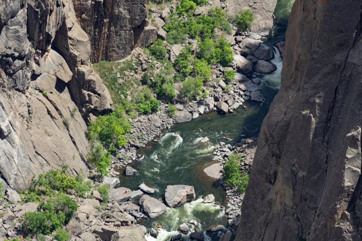
The Gunnison River cuts through some of the most dramatic terrain in North America. Below Blue Mesa Reservoir, the river enters a canyon so deep and narrow that sunlight reaches the bottom for only a few hours each day. Precambrian rock walls, nearly 2 billion years old, rise 2,000 feet above the water. The trout down there rarely see a fly.
This is not casual fishing. Getting to the best water requires steep hikes on unmaintained trails, 4WD roads that turn to mud in a rainstorm, and the kind of planning you would give a backcountry backpacking trip. The reward is Gold Medal trout water with big browns and rainbows in a setting that feels more like a geological expedition than a fishing trip.
The Gunnison has three distinct fishable sections, each with its own character:
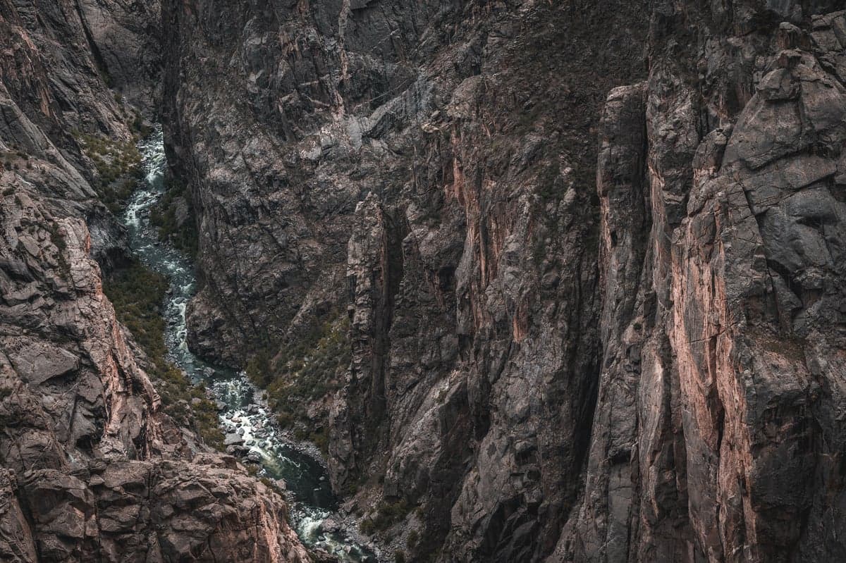
The dark Precambrian walls of Black Canyon rise over 2,000 feet above the Gunnison River. Sunlight reaches the canyon floor only a few hours per day in the narrowest sections.
Colorado Parks and Wildlife designated two stretches of the Gunnison as Gold Medal water: the 12-mile section from Almont downstream to the town of Gunnison, and the 27-mile stretch from Crystal Dam to the North Fork confluence. That second section, running through Black Canyon and the Gunnison Gorge, is where the real adventure is.
The Gunnison River flows west from its headwaters near Crested Butte, through the town of Gunnison, into Blue Mesa Reservoir, then through the Aspinall Unit dams (Blue Mesa, Morrow Point, Crystal) before entering Black Canyon National Park and the Gunnison Gorge. The nearest towns for the canyon and gorge sections are Montrose (population ~20,000) and the smaller community of Olathe, both on US-50 on Colorado's Western Slope.
East Portal Road drops from the South Rim of Black Canyon National Park to the river, losing nearly 2,000 feet of elevation in about 7 miles. The grade hits 16% in places with tight switchbacks. Vehicles longer than 22 feet (including trailers) are prohibited.
The road is open roughly May through November, depending on snow. When open, it provides the easiest vehicle access to the inner canyon, with about 2 miles of road alongside the river near Crystal Dam. The East Portal Campground has limited sites (reservations recommended).
Important restrictions at East Portal:
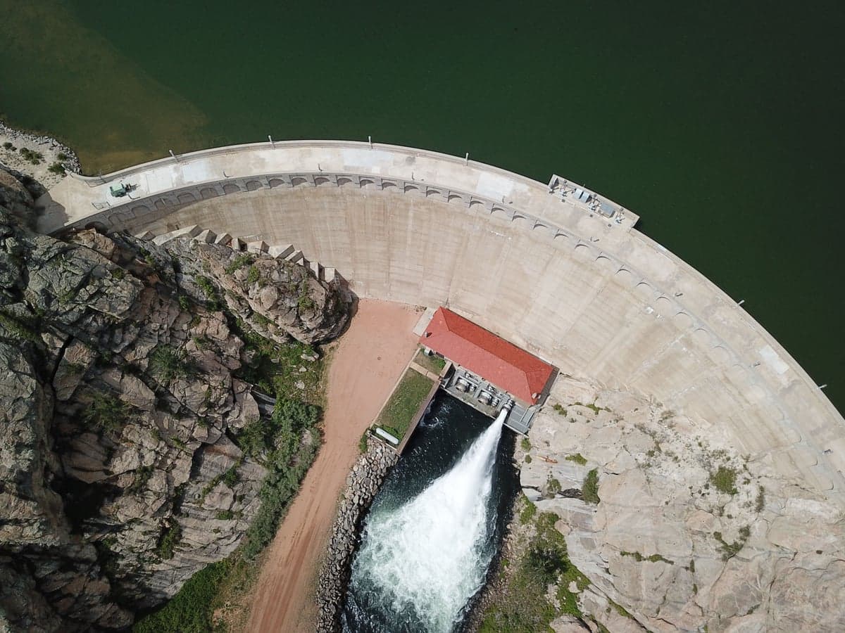
Crystal Dam controls flows into the Black Canyon. Releases from the Aspinall Unit dams keep water temperatures stable year-round, creating tailwater conditions that support a strong trout population.
The Gunnison Gorge National Conservation Area and Wilderness sits downstream of the National Park. There is no road access to the river. You hike in or float in.
Four trails reach the river:
| Trail | Distance | Elevation Drop | Notes |
|---|---|---|---|
| Chukar Trail | 1 mile | ~800 ft | Most popular. Primary put-in for float trips. Mule service available for gear. |
| Bobcat Trail | 1 mile | ~800 ft | Steep and rocky. Fishing access only. |
| Duncan Trail | 1.5 miles | 840 ft | Very steep final half-mile on loose scree. Not suitable for horses. |
| Ute Trail | 4.5 miles | Gradual | Longer but more moderate grade. Good for anglers who want to avoid the steep scrambles. |
All trailheads require high-clearance vehicles. The Chukar Road is 7 miles of unpaved surface that becomes impassable when wet. To reach the trailheads from Montrose, take US-50 to Olathe, turn east on Falcon Road, continue on Peach Valley Road past the staging area, then follow signs to your trail.
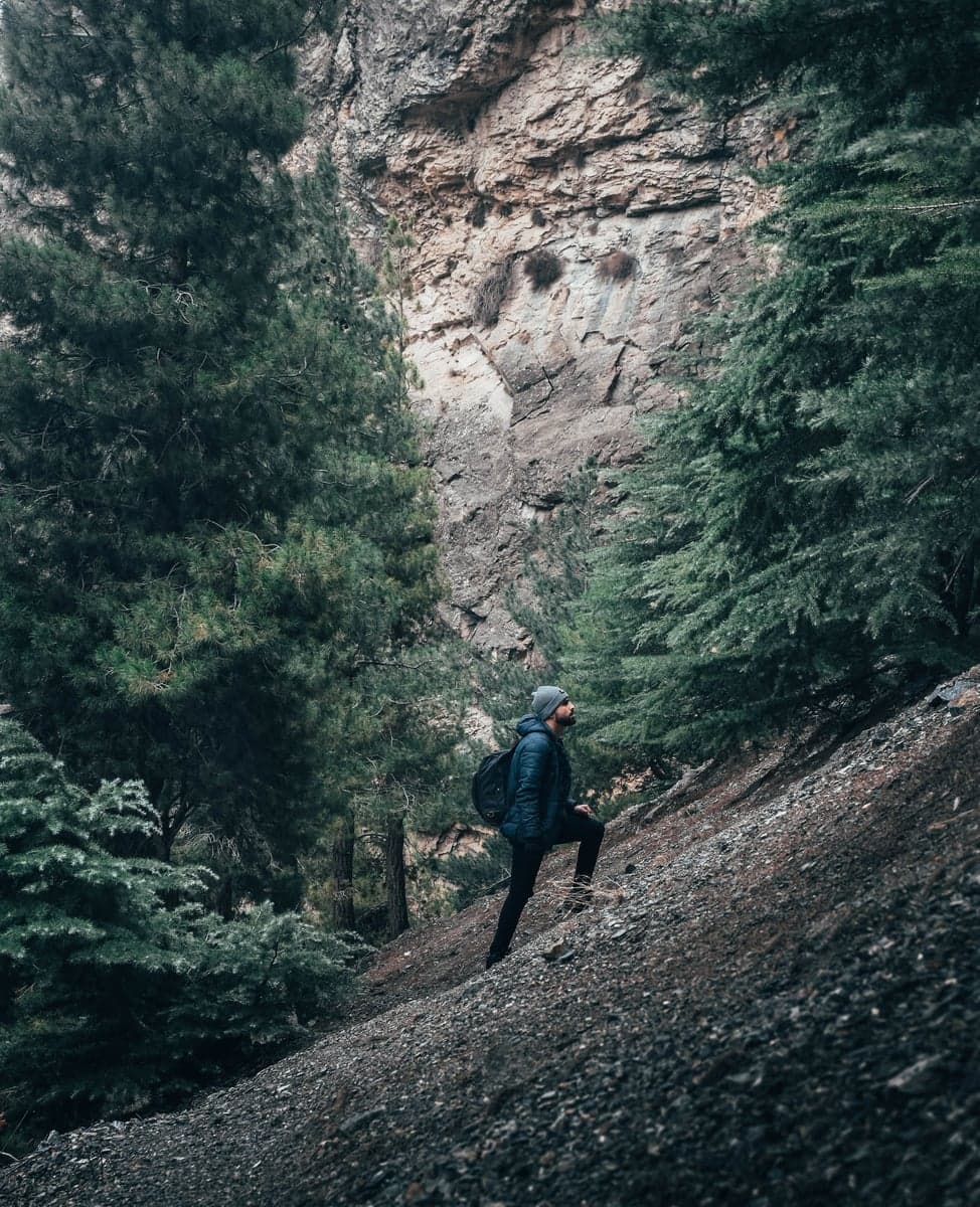
The trails into the Gunnison Gorge are short but steep. The Chukar Trail drops 800 feet in one mile. Carry plenty of water and start early in summer to avoid the afternoon heat.
Permits and fees: A wilderness day-use pass costs $3 per person. For overnight trips, camping permits are $10/person for one night, $15/person for two nights. Maximum stay is 2 nights / 3 days. Only designated campsites may be used. Campfires require firepans (no gathering wood), and you must pack out all human waste with an EPA-approved system.
The take-out for float trips is at Gunnison Forks or the Gunnison River Pleasure Park, about 14 miles downriver from the Chukar Trail put-in. Shuttle service is available through Pleasure Park at (970) 872-2525.
Below the confluence with the North Fork of the Gunnison near Delta, the river widens and slows. This 10+ mile section is best fished from a drift boat. Water temperatures run warmer, and the species mix shifts: rainbow and brown trout remain the primary targets, but flannelmouth suckers and native chub appear in the lower reaches during late summer.
Access here is straightforward. Pleasure Park at the North Fork confluence has campsites, cabins, a small fly shop, boat rentals, and river access. This is also the take-out for Gorge float trips, so you can combine a Gorge float with a day or two fishing the lower river.
The lower section sees considerably less pressure than the Gorge. For anglers traveling with family or less experienced fishing partners, the lower river is far more approachable: the wading is easier, the access is simpler, and you can fish from the bank without a steep canyon hike. Montrose Anglers and Ed's Fly Shop both run guided float trips on this section.
Regulations vary by section, so know where you are standing.
Black Canyon National Park (East Portal):
Gunnison Gorge Wilderness (BLM):
Upper Gunnison (Almont to Blue Mesa):
Always verify regulations at eRegulations Colorado before your trip. The rules can change between seasons.
The Gunnison below Crystal Dam is a tailwater. Flows depend on releases from the Aspinall Unit dams, managed by the Bureau of Reclamation. This means flows can be more predictable than a freestone river, but they also fluctuate based on reservoir levels and downstream irrigation demand.
| Flow Range (CFS) | Conditions |
|---|---|
| 200-400 | Low, clear, wadeable. Excellent for walk/wade fishing. Fish concentrate in deeper pools and runs. |
| 400-600 | Ideal fishing flows. Good wading with care. Fish spread into riffles and pocket water. |
| 600-1,000 | Wadeable for experienced anglers in the right spots. Drift boats work well. |
| 1,000-1,500 | Float fishing territory. Wading limited to edges and shallow bars. |
| 1,500+ | High water. Rafting conditions. Fishing is possible from a boat but challenging. |
Track real-time flows on RiverReports. The gauge below the Gunnison Tunnel (USGS 09128000) is the best indicator for the Gorge section.
Water temperatures stay remarkably stable thanks to the dam releases, typically running 42-58 degrees year-round in the canyon. This consistency creates tailwater conditions that support strong insect populations and keep trout feeding through the winter months when freestone rivers slow down.
The most accessible canyon water. Park at East Portal Campground and fish upstream or downstream along the road. The river here runs through massive boulders with deep pools, pocket water, and short riffles. Browns make up roughly 80% of the population, with rainbows accounting for the rest.
Fishing from the road access is relatively straightforward, but the inner canyon routes (Gunnison Route, Tomichi Route, and others from the rim) require serious scrambling. The National Park Service calls these "routes, not trails" for a reason. They are unmaintained, steep, and physically demanding. If you go, bring a helmet, sturdy boots, and do not attempt them in wet conditions.
This is the water that earns the Gunnison its reputation. The Gorge section flows through a wilderness canyon with sandstone and granite walls, Class III rapids, and long stretches of prime trout habitat. Fish here see far less pressure than on the East Portal section or any roadside river in Colorado.
The Gorge is best experienced as a multi-day float trip. Ed's Fly Shop in Montrose and RIGS Fly Shop in Ridgway both hold BLM permits for guided float trips. A typical 2-3 day trip runs $1,200-2,000+ per person including camping, meals, and guide. Book by March for peak season (June).
Walk/wade anglers can hike in via any of the four trails and fish upstream or downstream from where they reach the river. The Chukar access point puts you at the top of the float run, with good pocket water and riffles immediately available. The Duncan Trail drops you into the middle of the Gorge, where you can fish less-pressured water in both directions. Most walk/wade anglers fish within a mile of their trail access, though if you are willing to boulder-hop along the banks, you can find water that has not been fished in days.
Insider tip: The Bobcat Trail gets the least foot traffic of the four. It is steep and rough, but the water on either side of the Bobcat access point receives a fraction of the pressure that the Chukar and Duncan areas see. If you can handle the scramble, it is worth the effort.
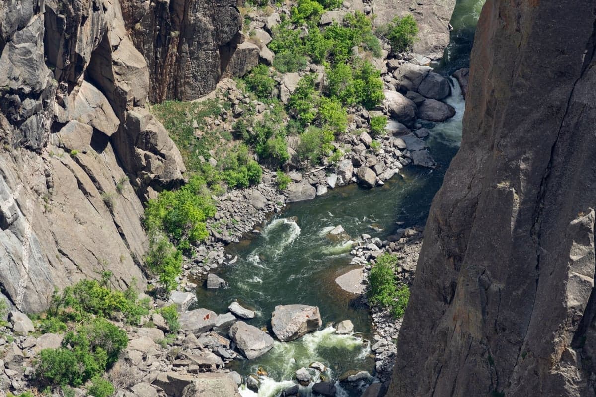
The Gunnison runs over canyon boulders the whole way through the Gorge. They are slick, the current between them is strong, and a wading staff is not optional at flows above 400 CFS.
Notable rapids in the Gorge for floaters: Chukar Rapid (Class III-) near the put-in, then Buttermilk, Red Canyon, Boulder Garden, The Squeeze (Class III+), Cable (Class III+), and Grand Finale in the miles 7-9.5 section. American Whitewater rates the overall run as Class III.
The upper river above the reservoirs fishes differently. This is a freestone section with easier road access, gentler wading, and a mix of rainbow, brown, and cutthroat trout. The water near Almont (where the East and Taylor rivers converge to form the Gunnison) is Gold Medal designated and provides consistent summer hatches.
This section is a good option for anglers who want Gunnison River trout without the demanding canyon access. It is also a natural add-on if you are visiting Crested Butte, which sits about 30 miles north. Several campgrounds (Almont, Lakeview, Mesa) provide access along the river corridor.
Spring fishing on the Gunnison starts slowly. Midges dominate through March and into April, with BWOs joining the mix as water temperatures climb. Stonefly nymphs become effective by late April. East Portal Road typically opens sometime in May (snow dependent), and flows begin to rise with snowmelt from the surrounding mountains.
The upper Gunnison above Blue Mesa sees runoff earlier than the tailwater sections below Crystal Dam. On the tailwater, dam releases moderate the spring rise, keeping the fishing more consistent.
The salmonfly hatch in late May through mid-June is the event of the year. These 2-3 inch stoneflies bring big browns to the surface, and for a few weeks the fishing is as good as it gets on any Colorado river. The hatch moves upstream over a period of 2-3 weeks, so if you miss it in the lower Gorge, you may catch it higher up. Golden stoneflies, yellow sallies, caddis, and PMDs follow closely behind. Call RIGS or Ed's the week before your trip to ask where the hatch front is sitting.
By July, the Gorge finds its summer rhythm: morning nymphing in the deep runs, midday hopper-dropper along the grassy banks (the canyon walls create pockets of shade where fish sit and wait for terrestrials), and evening caddis rises that can be dense in the flat glides. Position yourself downstream of rising fish and cast upstream into the feeding lanes. Water temperatures in the tailwater stay cold enough to keep fish active all day, unlike freestone rivers where afternoon heat shuts things down.
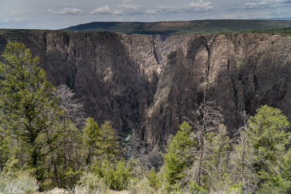
The Gunnison Gorge in summer. Canyon walls hold shade through much of the day, keeping water temperatures stable even as the desert landscape above bakes in the heat.
Summer is also peak season for multi-day float trips through the Gorge. Guided trips combine Class III whitewater with fishing, camping at designated riverside sites. Late June through July offers the best combination of stable flows and active hatches.
Fall is prime time for anglers who want big fish. Brown trout begin staging for the spawn by late September, and their aggression toward streamers builds through October. A Woolly Bugger or Sculpin pattern swung through a deep pool at first or last light can produce the fish of the season.
BWOs provide consistent dry fly action on overcast afternoons. Tricos appear in the morning on some stretches. The upper river near Almont sees Kokanee salmon running upstream from Blue Mesa Reservoir, and the big browns follow them.
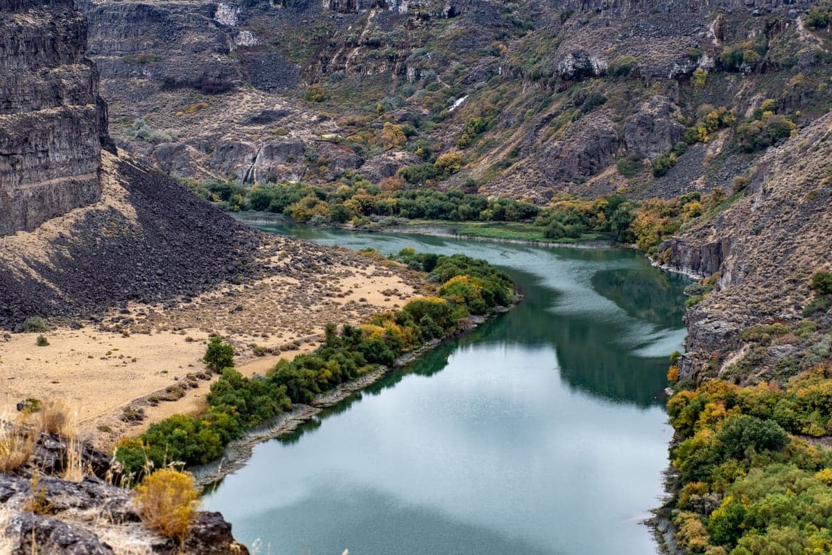
Fall along the Gunnison brings color to the canyon walls and aggressive brown trout to the river. September through early November is the best window for streamer fishing.
Crowds thin dramatically after Labor Day. By October, you may have an entire section of the Gorge to yourself.
Stable tailwater flows and cold, clear water keep winter fishing worthwhile on the Gunnison. Midges dominate, with occasional BWO activity on warmer afternoons. Fish hold in deep runs, soft inside seams, and slow tailouts.
The best window is 11am to 3pm, when water temperatures climb a few degrees and insect activity picks up. East Portal Road closes for the winter (typically November through April or May), but the Gorge trails remain open year-round. Getting to the trailheads requires 4WD, and the hike down in cold conditions demands extra preparation.
Winter flows typically run 500-600 CFS in the upper river, 1,000-1,100 CFS through the Gorge, and 1,900-2,000 CFS in the lower section.
The Gunnison has diverse hatches thanks to its tailwater character and cold, clean water.
| Season | Hatches | Key Patterns |
|---|---|---|
| Winter (Dec-Mar) | Midges, BWOs | Zebra Midge #18-22, Black Beauty #18-22, RS2 #18-22, Juju Baetis #18-20 |
| Spring (Apr-May) | Midges, BWOs, early stonefly nymphs | BWO Parachute #18-20, Pheasant Tail #16-18, Pat's Rubber Legs #8-10 |
| Late May-June | Salmonflies, Golden Stones, Yellow Sallies, Caddis, PMDs | Chubby Chernobyl #8-12, Stimulator #8-12, Elk Hair Caddis #14-18, PMD Sparkle Dun #16-18 |
| Summer (Jul-Aug) | Caddis, PMDs, Hoppers, BWOs | Hopper #10-14, Elk Hair Caddis #16-18, Parachute Adams #14-18, Woolly Bugger #8-10 |
| Fall (Sep-Nov) | BWOs, Midges, spawning browns | Streamer #4-8, BWO Parachute #18-20, Zebra Midge #18-22, Sculpin #6-8 |
Gear notes: A 6-weight rod is the standard recommendation for the Gunnison, heavier than most Colorado tailwaters. The fish are big, the wind can howl through the canyon (especially in spring and fall), and you need the backbone to throw large stonefly dries or heavy streamers. Bring a 5-weight as a backup for delicate dry fly work. Leaders should run 4X-5X for general use, dropping to 6X for midge and BWO presentations. In the winter, 12-14 foot leaders with 6X tippet are standard for spooky fish in low, clear water.
What to pack for a Gorge trip: Beyond your fishing gear, bring a wading staff (collapsible is fine), a good headlamp for early starts and camp, Tecnu soap (for poison oak exposure), at least a gallon of water per person per day, sun protection, and a waterproof bag for your phone and wallet. If you are staying overnight, add a camp stove (no wood fires), firepan with charcoal, and a WAG bag system for human waste.
The 14-mile Gunnison Gorge float is one of the best multi-day river trips in Colorado, combining wilderness scenery with Gold Medal fishing and manageable whitewater.
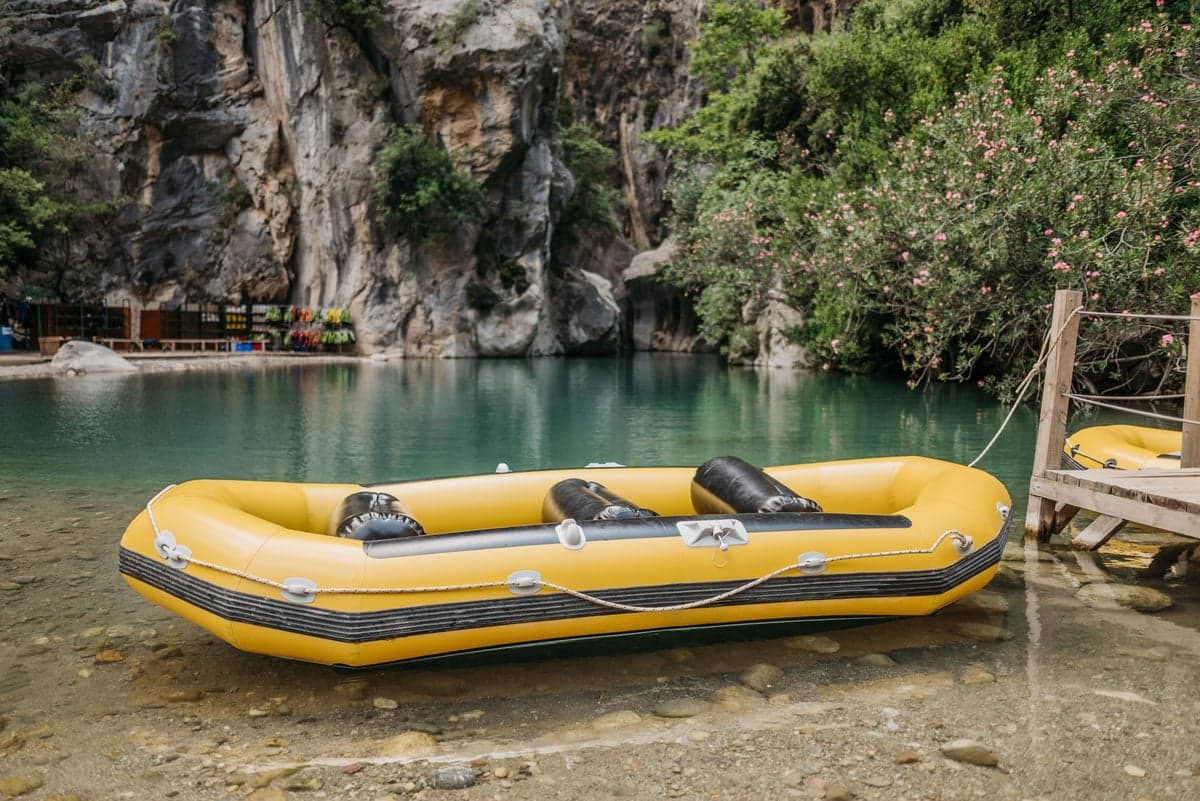
Float trips through the Gunnison Gorge are the best way to cover the full 14 miles of Gold Medal water. Most anglers opt for 2-3 day trips with guided outfitters.
Logistics:
Camping: First-come, first-served at designated boater sites. Register at the trailhead on launch day (no advance sign-ins). Blue boater sites only for overnight float parties. Bring a firepan and charcoal (no wood fires), and an EPA-approved waste carry-out system.
The most common itinerary is a 2-day/1-night trip, though 3-day trips allow more fishing time. Guided float trips with Gunnison River Expeditions (operating since 1985), Ed's Fly Shop, and Montrose Anglers handle all the logistics. A guide is worth the investment on your first trip through the Gorge, as the canyon navigation requires local knowledge.
The Gunnison demands more preparation than most Colorado fisheries. Take these seriously.
Canyon access: The trails into the Gorge are short but steep. The Duncan Trail's final half-mile is loose scree on a steep grade. Start early in summer to avoid midday heat. Carry at least a gallon of water per person per day. If you are hiking with fishing gear, secure your rod in a tube or strap it carefully. A fall on these trails can end a trip (or worse).
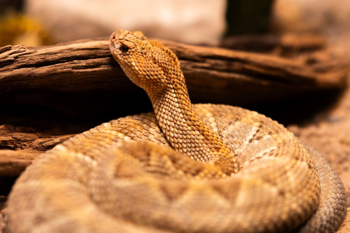
Rattlesnakes are common along the Gorge trails and riverside camps. Check boots, wading gear, and sleeping bags before use. Give snakes wide clearance on the trail.
Wildlife: Rattlesnakes (pygmy and prairie varieties) are common along the trails and in riverside camps from spring through fall. Bark scorpions inhabit the canyon as well. Check boots, wading gear, and sleeping bags before putting them on. Poison oak and poison ivy grow along the river corridor.
Wading: The canyon boulders are slick, and the current is powerful even at moderate flows. A wading staff is not optional at flows above 300-400 CFS. Felt-soled boots provide better traction than rubber on the granite and schist. If you fall in, the next pool may be a long swim through cold water.
Weather: Summer afternoon thunderstorms can develop quickly. The canyon concentrates heat in summer (temperatures above 100 degrees on the rim) and cold in winter. Lightning in the canyon is particularly dangerous because there is nowhere to go.
Remoteness: There is no cell service in the canyon. The Gorge is a designated wilderness area. If something goes wrong, evacuation requires hiking out or waiting for a float to reach the take-out. Carry a first aid kit, and consider a satellite communicator (InReach or similar) for emergencies.
Roads: The 4WD roads to the trailheads become impassable when wet. Check weather before committing to the drive. If it rains while you are in the canyon, your vehicle may be stranded at the trailhead until the road dries.
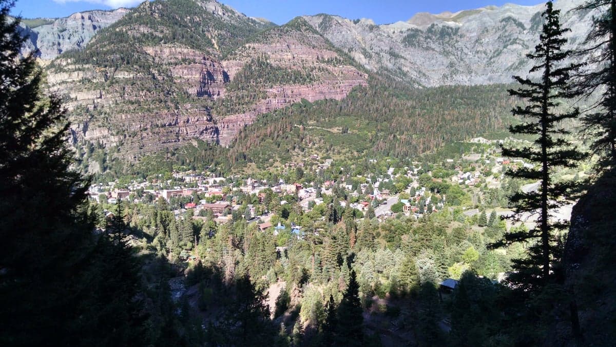
The towns of Ouray, Ridgway, and Montrose on Colorado's Western Slope provide easy access to the Gunnison Gorge along with lodging, food, and fly shops.
Montrose is the largest town near the Gorge and the best base for most trips. It sits on US-50, about 15 minutes from the Black Canyon National Park entrance and 30-45 minutes from the Gorge trailheads. Hotels, motels, and vacation rentals are available. Ed's Fly Shop at 432 E Main St has gear, guides, and up-to-date fishing reports.
Ridgway (30 minutes south of Montrose on US-550) is where RIGS Fly Shop has operated since 2001. It is a quieter base with a Western small-town feel, closer to Ouray and the San Juan Mountains.
Gunnison and Crested Butte are better options if you are fishing the upper river above Blue Mesa. Check the Crested Butte destination guide for details on lodging and trip planning in that area.
Camping: East Portal Campground (reservations at recreation.gov) sits right on the river. Almont Campground and several Forest Service sites serve the upper river. For the Gorge, riverside camping at designated wilderness sites is part of the experience on multi-day float trips.
For food in Montrose, Garlic Mike's serves Italian on Rose Lane, and the Daily Bread Bakery on Main Street does solid breakfast burritos and lunch. Colorado Boy Pizzeria and Brewery is about a mile from downtown.
Everything this river feeds, by month. Filter by bug, category, or fly size, and switch the axis to see what comes off at what time of day. Pulled from our western hatch and forage guide.
Track Gunnison River conditions on RiverReports before you drive. The two key gauges to watch:
For wade fishing in the Gorge, look for flows between 300-600 CFS on the below-tunnel gauge. For float trips, 800-1,500 CFS provides the best combination of fishable water and navigable rapids.
The Gunnison is a tailwater below Crystal Dam, so flows can change based on Bureau of Reclamation release schedules. In drought years (like recent seasons), expect lower releases and reduced flows in the canyon. Check flows the day before and the morning of your trip.
For a broader view of Colorado fishing conditions across the state, visit the Colorado river guide.
Weekly flow updates and fishing intel.
© 2026 RiverReports, Inc.