
Deckers
Marginal
Flow110 CFS
Trendstable
Claritygin clear
TempCool at dawn, climbing toward the 67F stop-fishing threshold on hot afternoons
UV Scud Olive #16-18BH Hare's Ear #16-20San Juan Worm #10Micro Chubby Tan #16
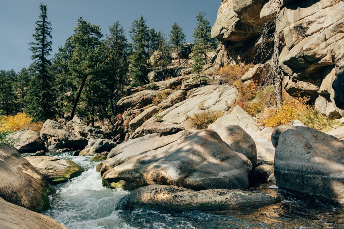
| What | When | Key Numbers |
|---|---|---|
| Summer's real risk | Jun-Sep | Burn-scar sediment; clarity drops with almost no change in CFS |
| Ideal flow window | Any month | 150-400 CFS per local shops; below 150 turns technical |
| Typical flow by season | Gauge medians, 2002-2026 | Aug ~320 CFS, Jul ~293, May ~232, Jan ~141, Nov ~95 |
| Regulations | Wigwam Club north boundary to Scraggy View | Flies and lures only; 2 trout, 16-inch minimum |
| Best crowd window | Nov-Mar, and weekday mornings year-round | Summer weekends put cars every few hundred yards |
| Winter feeding window | Nov-Mar | Roughly 11am-3pm; midges #18-24 |
| Local fly shop | Flies & Lies in Deckers | (303) 647-2237, 8570 S Hwy 67 |
| Guided trips | Book by February for summer | $365-445 half day, $445-645 full day (1-3 anglers) |
Deckers is the roadside stretch of the South Platte below Cheesman Canyon, Gold Medal water you can be standing in four minutes after you shut the car door. CO-67 and County Road 126 run along it, pullouts line the corridor, and it is probably the most-fished trout water within an hour of Denver.
Which is why almost every page about this river opens with a CFS number, and why that is the wrong number to open with between June and September. Deckers sits directly below the 2002 Hayman burn scar. A thunderstorm over those bare granite slopes puts a sediment slug in the river inside an hour, and the flow gauge barely notices. You can leave Denver on a clean 280 CFS reading and arrive at coffee-colored water with 280 CFS still on the screen.
So this page runs in that order. First, how to read a burn-scar day, because that is the thing no flow chart will tell you and the reason most wasted drives out here get wasted. Second, what the gauge genuinely is good for: how much water is moving, and how many people are likely standing in it.
If you want the same river with harder fish and a 1.5-mile hike, that is Cheesman Canyon immediately upstream. The whole drainage in one view is the South Platte hub.
In June 2002 the Hayman Fire burned roughly 138,000 acres of the Upper South Platte watershed, most of it above Deckers, and it was the largest wildfire in Colorado history at the time. Two decades on, large parts of that footprint have not come back as forest. Ponderosa needs surviving parent trees to reseed, the seed does not travel far, and the country has run hot and dry enough that natural regeneration has largely failed. Much of the scar is now grass and shrub on steep, decomposed granite.
Decomposed granite on a bare steep slope does not absorb a cloudburst. It moves.
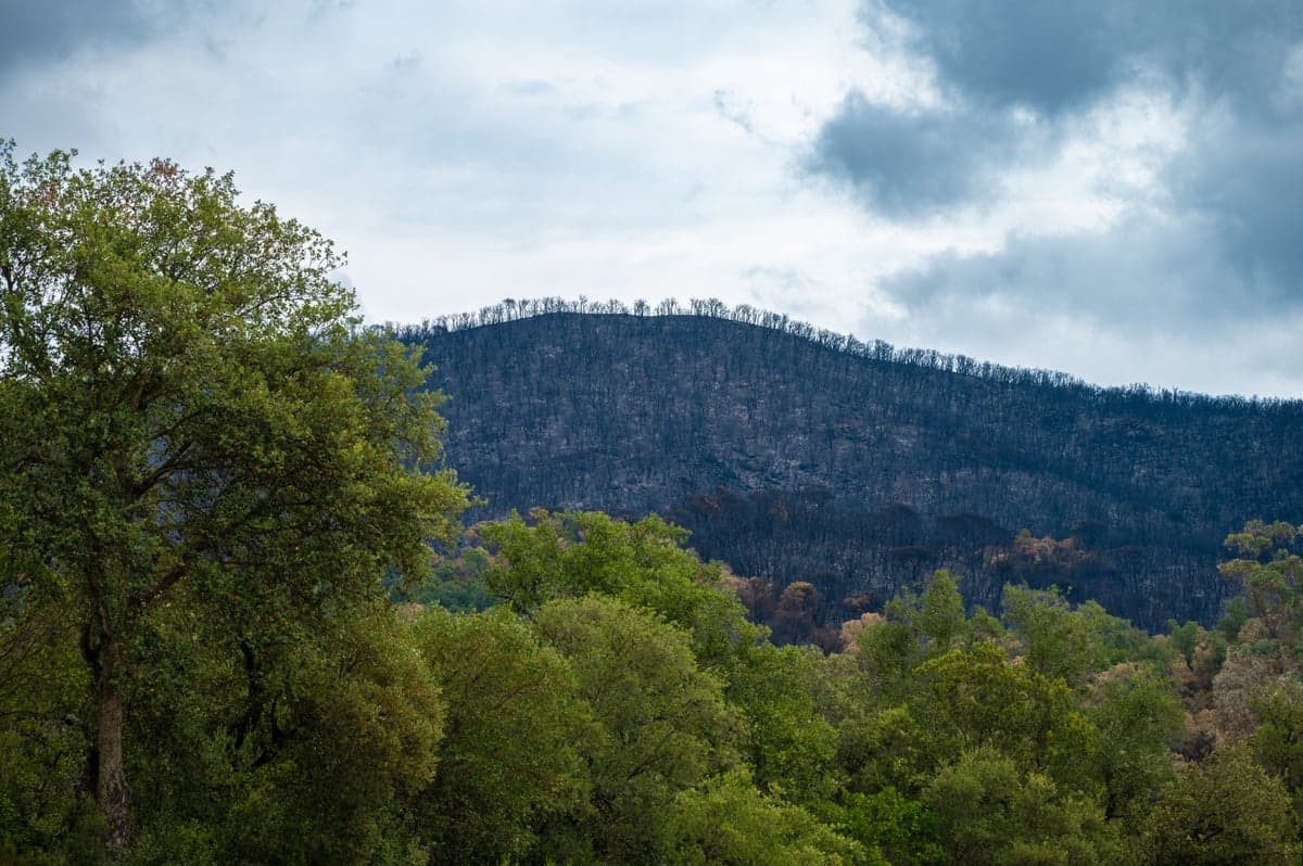
Burned slope with partial regrowth. Where the Hayman scar has come back as grass and shrub instead of forest, there is little to hold decomposed granite in place during an intense storm.
On July 31, 2023 a cell parked over the scar and Denver Water's gauge near Cheesman Reservoir recorded over three inches of rain in roughly an hour. Sediment slides came off the canyon walls, built alluvial fans into the channel, and buried named holes in Cheesman Canyon that had fished the same way for decades. Everything that moves through the canyon eventually moves through Deckers. Longtime South Platte guide Pat Dorsey described the river as being in complete shambles inside two days, and it took an above-average snowpack plus a deliberate 200 CFS bottom release from Denver Water in June 2024 to flush the channel back out.
That was the extreme version. Smaller ones happen most summers, and they are why a clear 7am gauge reading is not a promise about noon.
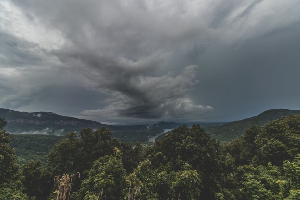
An afternoon cell building over high country. What a storm like this does over the burn scar in the next hour matters more to your day than the current gauge reading.
These are sediment events, not volume events. The gauge may barely move while visibility drops to inches. Anyone waiting for the flow line to jump before changing plans is going to make the drive.
Brush Creek, West Creek and the smaller gulches along the corridor are what deliver the material. The main stem can look fine above a tributary mouth and run chocolate a hundred yards below it. Work out which side creeks drain whatever got rained on.
If a cell sat over the country west and south of Deckers in the past 24 hours, plan on off-color water even with a normal flow reading. Burned ground responds in minutes. On nearby West Creek, 2.2 inches of rain pushed flows from 62 to 2,170 CFS inside 45 minutes and breached CO-67.
The upside of a sediment pulse is that it passes. Deckers usually comes back in 24 to 72 hours rather than the week a freestone needs after runoff. Mud on Saturday often means a fine Monday.
Eleven Mile Canyon and the Dream Stream sit above Cheesman Reservoir, outside the Hayman footprint entirely. When a burn-scar storm dirties Deckers, that side of the drainage is usually clean. Pick your alternative at the kitchen table, not at the pullout.
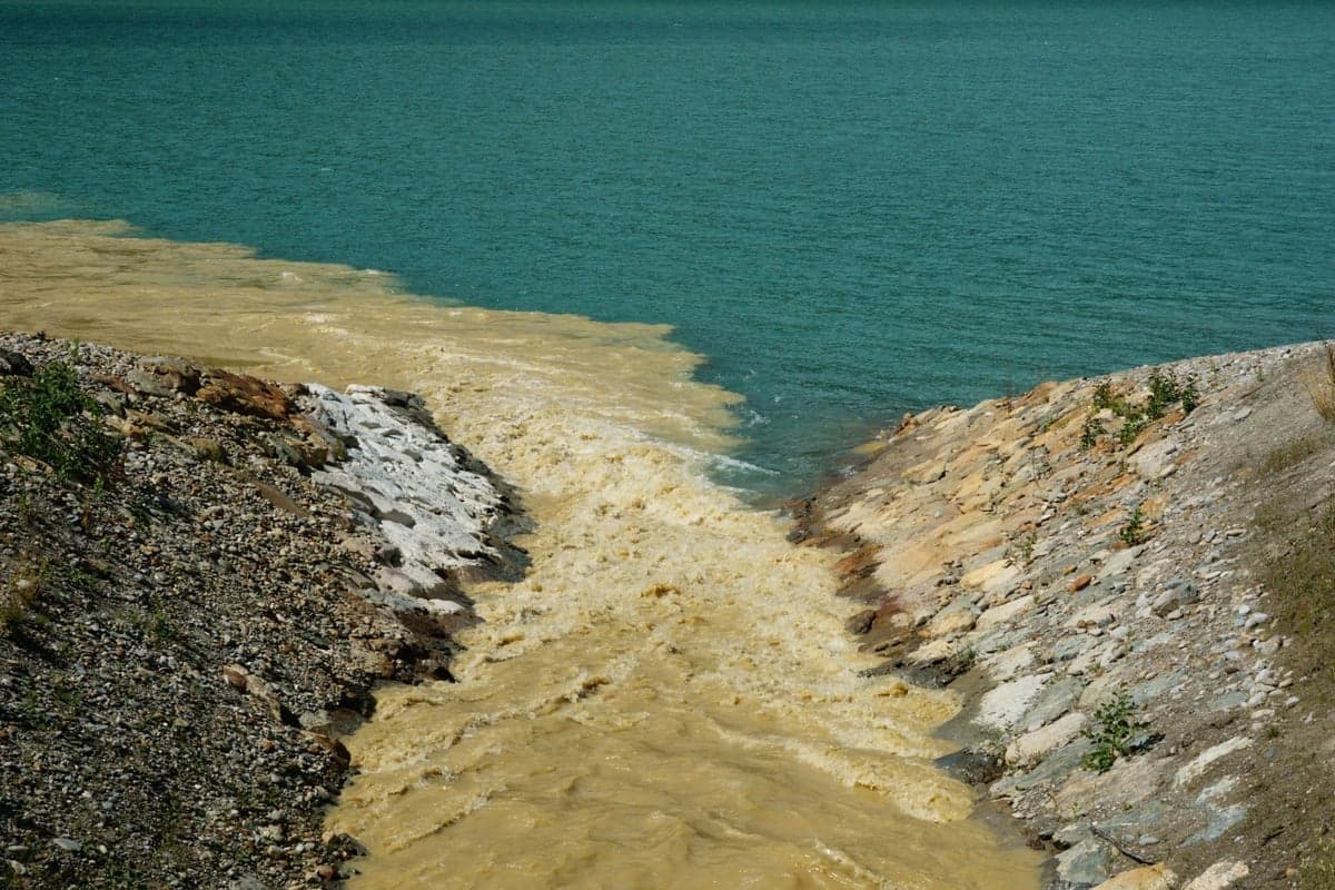
Sediment-laden water meeting clear water, with a hard line between them. That line is the practical signature of a burn-scar storm, and on the river it shows up where a dirty tributary comes in.
Sediment meets clear water in a hard seam, usually at a tributary mouth. Walk upstream of it and fish. Trout on the clean side of a plume often feed hard, and the color below buys you cover you never get here otherwise.
Once mud is ruled out, the gauge earns its keep. The one that matters is South Platte River below Brush Creek near Trumbull, which sits inside the water you will fish rather than upstream of it. Live readings are on RiverReports.
Shops including Blue Quill Angler and Pat Dorsey Fly Fishing put the ideal Deckers window at 150-400 CFS, and that range repeats consistently enough across independent sources to trust. What almost nobody publishes is how often the river is actually in it.
Historical medians at the Trumbull gauge for the middle of each month, from more than two decades of record:
| Month | Median CFS | What that means in practice |
|---|---|---|
| January | 141 | Below the "ideal" window. Low, clear, technical, empty |
| February | 108 | The lowest month of the year. Pure sight fishing |
| March | 127 | Still low. Baetis begin on overcast afternoons |
| April | 151 | Bottom edge of the ideal window |
| May | 232 | Solid. Often the best water quality-to-crowd ratio of the year |
| June | 203 | Variable. Release-dependent, not runoff-dependent |
| July | 293 | Prime flow, peak crowds, peak heat risk |
| August | 321 | Highest median of the year in typical seasons |
| September | 226 | The sweet spot. Good flow, fall bugs, crowds thinning |
| October | 129 | Drops off sharply. Back to technical fishing |
| November | 95 | Lowest of the late season. Very few anglers |
| December | 133 | Winter pattern established |
Line those medians up against 150-400 CFS and Deckers spends roughly six months a year under the bottom of it. That does not make those months bad. It makes them different. The 150-400 advice is summer advice, and treating a 120 CFS January reading as a problem is the most common mistake visiting anglers make here. February at 108 CFS is not a broken river. It is a sight-fishing river, and it is empty.
This is a tailwater, so the number is a reservoir release decision rather than a weather report. A cold front does not lower the flow. Releases can step up or down by a hundred CFS overnight with no announcement, and both the fish and the fishing take a day or two to settle afterward. General mechanics are in understanding river CFS flows.
Read down to your flow band, then across. The crowd columns carry as much weight as the flow ones on this river, because at Deckers the angler who got to your run first affects your day more than your fly selection does.
| Flow | Character | Crowd (weekend) | Crowd (weekday) | What works |
|---|---|---|---|---|
| Under 100 CFS | Rare, mostly Nov-Feb or deep drought. Every fish is visible and so are you | Light | Very light | Sight nymphing, #22-26 midges, 7X, 12-ft leaders, upstream approach only |
| 100-150 CFS | The winter and late-fall normal. Gin clear, fish stacked in deeper slots | Moderate near the bridge, light downstream | Light | Two-fly midge rigs, small scuds, tiny split shot, long drifts through one seam |
| 150-250 CFS | Genuinely good water. Enough current to hide your mistakes, not so much you cannot read it | Heavy | Moderate | Standard nymphing, dry-dropper, Baetis in spring and fall |
| 250-400 CFS | Textbook Deckers. Fish spread into riffles and pocket water | Very heavy May-Sep | Moderate to heavy | Heavier nymph rigs, hopper-dropper, evening caddis, more forgiving presentations |
| 400-600 CFS | High and pushy. Wading gets real. Fish move to edges and soft seams | Moderate, many anglers stay home | Light | Bank edges, bigger attractor nymphs, San Juan Worms, streamers on the swing |
| Above 600 CFS | Wade with genuine caution or not at all | Light | Light | Fish from the bank, target protected pockets, or drive to another section |
If weekends in summer are your only option, get there at first light, walk ten minutes from the car, and accept company. Or read the section on who should skip this river entirely.
The burn scar sleeps from November to March, the crowds go home, and what is left is the version of this river that rewards showing up. Deckers in January is better than most people think.
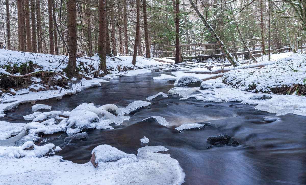
Ice shelves building along a shaded bank with open water in the middle. Bottom-release water out of Cheesman keeps most of the Deckers corridor open through the cold months, but the shelves limit where you can safely stand.
Cheesman releases from depth, so water leaving the dam in January is warmer than a freestone at the same elevation. The river stays largely ice-free, midges hatch every month, and the trout keep eating. Flows sit in that 95-141 CFS median band, which means clear water and predictable holding lies.
Roughly 11am to 3pm, when water temperature climbs a few degrees. Before that, fish are lethargic. After that, they shut down. Do not set a 5am alarm in February. Get there at 10 and be efficient.
Local reports through winter 2026 leaned on Black Beauty, Mercury Midge, Zebra Midge, RS2, WD-40, JuJu Baetis and small Pheasant Tails in sizes 18-24. Deep and slow under an indicator, with long tippet. At 110 CFS and 34-degree water the drift and the depth are the whole game: a perfect drift with a mediocre fly beats the reverse every time.
Ice shelves build along shaded banks and look solid when they are not. Guides run fewer, longer drifts through each seam rather than covering water. CO-67 north of Deckers ices up and the CR-126 approach can be snowpacked. Bring fingerless gloves, hand warmers, and something to clear your guides. If winter tailwaters are your thing, see our January winter fly fishing rivers roundup and the year-round tailwaters guide.
Deckers is a small-fly river with a handful of exceptions. If you are not comfortable below size 18, this water will teach you.
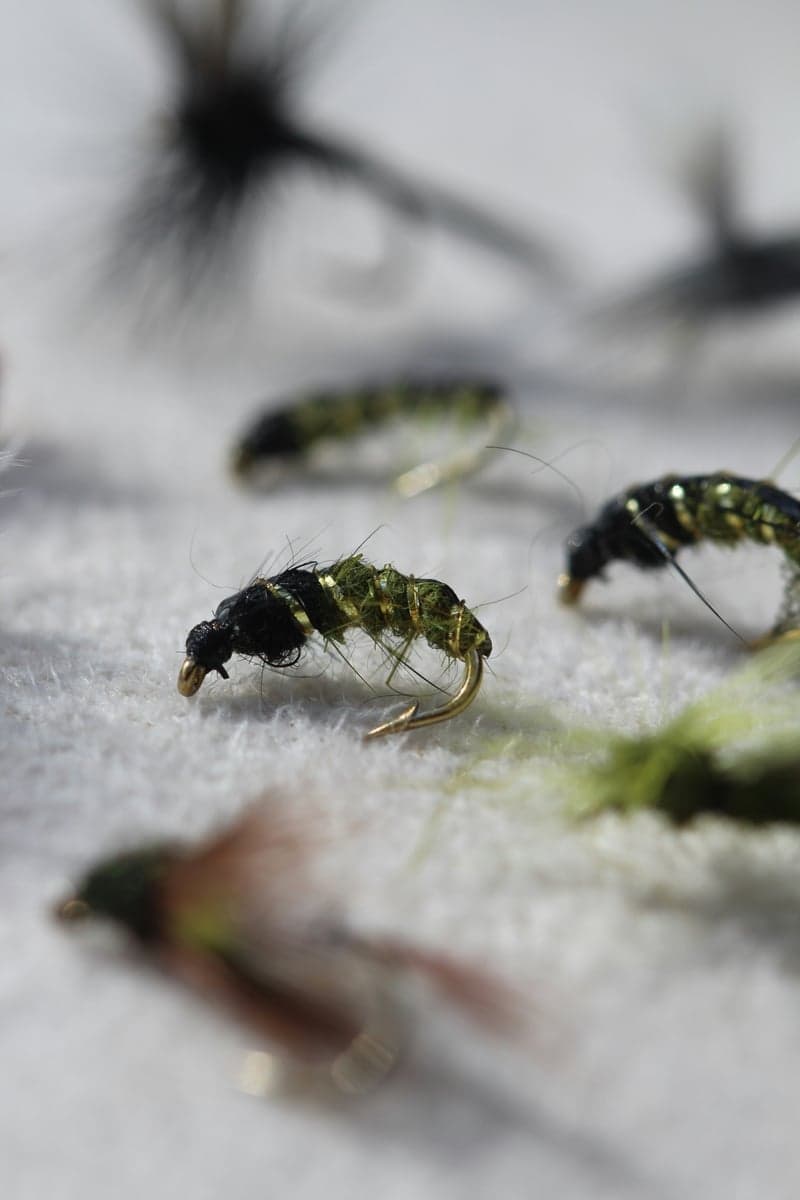
A Deckers box leans small. Midges and Baetis carry more than half the year, with a short window in summer where you can size up.
Year-round: midges. The backbone. Black Beauty #20-24, Zebra Midge #18-22, Mercury Midge #20-22, Top Secret Midge #20-24, RS2 #20-24.
Spring and fall: Baetis. Best on overcast, drizzly afternoons from March into May and again September into November. JuJu Baetis #20-22, WD-40 #18-22, Barr's Emerger #20-22, Parachute BWO #18-22.
Summer: Tricos, PMDs, caddis, yellow sallies. Trico spinner falls at dawn through about 8am from late June into September are the signature Deckers surface event. PMDs and caddis come off midday to evening. Yellow Sallies #12-16 in early summer. Elk Hair Caddis #16-18, Hackle Wing PMD #20, Trico Spinner #20-24.
Summer: terrestrials. July through September along grassy banks. Micro Chubby #16, Foam PMX Tan #10, Parachute Ant #18, small hoppers #12-14. Dry-dropper with a small emerger below is the standard rig.
Year-round sleeper: scuds. The vegetated runs at Deckers support a real scud population, and a UV Scud Olive #14-18 produces in every season. One of the few larger patterns that consistently works here.
Fall: streamers and eggs. Brown trout spawn in October and November, and the weeks ahead of it bring the most aggressive streamer eating of the year. Woolly Bugger #6-8, Thin Mint #6-8, plus micro eggs #18 once fish are on gravel. Read our fall spawn and redd guide and stay off the redds.
A guide that tells everyone to come is useless. Go somewhere else if:
Access here is genuinely easy, which is exactly why people get careless about property lines. Denver Water publishes an access map for the corridor from Deckers to Buffalo Creek showing public reaches in green, closed reaches in red, and several stretches where only one bank is open. Worth a look before a first trip.
The private water is the thing to get right. Going upstream from the town of Deckers toward Cheesman Canyon, the public water ends at the Wigwam Club, a long-established private fishing club whose water sits between the canyon and Deckers. Public access resumes below the club's lower boundary and runs, with a few clearly marked private inholdings, downstream toward the North Fork confluence.
The boundaries are posted. Anglers still wade into them, usually by working upstream and never looking up. Two rules keep you out of trouble:
The Gill Trail trailhead on CR-126 southwest of town accesses Cheesman Canyon, not Deckers. Different water, different regulations, different day.
Get this right. The rules change twice within a five-mile stretch of road.
Deckers section (lower/north boundary of Wigwam Club downstream to Scraggy View Picnic Ground):
Cheesman Canyon (Cheesman Dam downstream to the upper boundary of Wigwam Club), immediately upstream:
That difference catches people. A legal 17-inch brown at Trumbull is not a legal fish two miles up the Gill Trail. Details on the upstream rules are on the Cheesman Canyon page.
A Colorado fishing license is required, plus a Habitat Stamp for anglers in the covered age range. Regulations change year to year, so check the current Colorado Parks and Wildlife rules before each trip rather than trusting this page or any other. Most anglers here release everything regardless of the two-fish allowance, and both local shops encourage it.
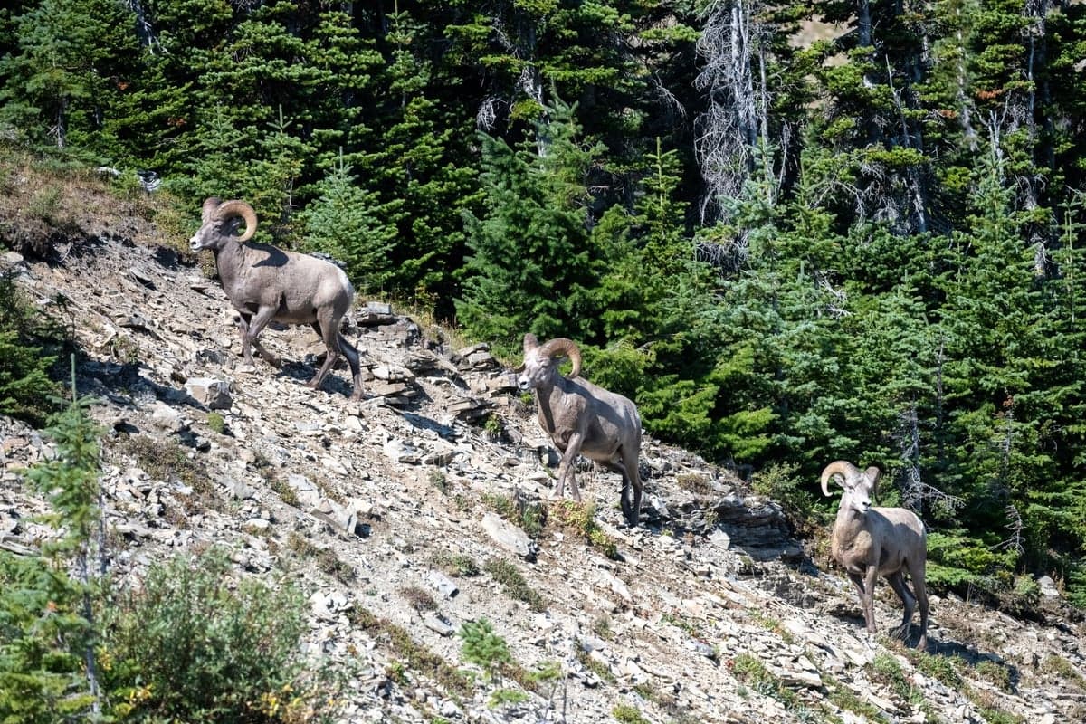
Bighorn sheep, mule deer, black bear and rattlesnakes all use the corridor. Watch where you step on warm rock in summer.
Wading. Granite slabs and rounded cobble, both slick. At 400 CFS and up the current is stronger than the surface suggests. Our how much CFS is too high to wade guide is a useful sanity check.
Flash flooding. The burn scar cuts both ways. Steep tributary drainages below bare slopes rise fast in a thunderstorm. Do not park or fish in a tight gulch mouth when a cell is building.
Heat stress on fish. The genuine summer risk at Deckers is not to you. Low flows plus afternoon sun push water temps toward the lethal range for trout. Fish early, check the temperature, stop at 67F.
Roadside traffic. You are fishing next to a two-lane highway with blind curves. Park fully off the pavement and watch children and dogs near the pullouts.
Winter driving. CO-67 north of Deckers and CR-126 toward Cheesman can be icy or snowpacked November through March.
Wildlife. Black bears and mountain lions use this corridor, but the animal you are actually likely to meet is a rattlesnake stretched out on warm granite in July. Look before you put a hand down when you are scrambling between pullouts.
Leader and tippet. Longer than you think. 9 feet at 300 CFS, 10-12 feet below 150 CFS. 5X to 6X fluorocarbon to the lead fly, 6X to 7X to droppers. This water punishes heavy tippet more than it punishes fly choice.
Indicators. Small. A bobber sized for the Colorado in June will spook fish here at 110 CFS.
Rod. 9-foot 4 or 5 weight. Some regulars drop to a 3 weight for the winter midge game.
Optics and a wading staff. Polarized amber or copper, because sight fishing is a core technique in the low-water months. A staff earns its keep on granite that is slicker than it looks.
Thermometer. Not optional in July and August. Both local shops tell anglers to stop at 67F, and at low flows the river gets there faster than you expect. Our water temperature guide explains why. Rubber net, and keep the fish wet.
Gold Medal designation requires at least 60 pounds of trout per acre and at least 12 trout over 14 inches per acre. Discover Deckers cites CPW figures of roughly 3,000 trout per mile here, a strong number for water this accessible. Composition is browns and rainbows with cutbow hybrids mixed in. Fish in the 10 to 16 inch range make up most of what you catch, with 18 to 20 inch fish present throughout.
The 2023 sediment event is worth remembering as a population story. Rainbow redds upstream were buried under decomposed granite that winter and spring, and Pat Dorsey expected to lose an entire year class. This fishery is durable but it is not immune, and the fire footprint above it is a permanent feature of how it behaves.
The corridor sees kayakers, tubers and paddleboarders in summer. The signature feature is the Chutes, which American Whitewater rates Class III- at most levels, with the surrounding run mostly Class II. Common practice is to put in at the West Pine Creek Road parking area and take out at the Colorado Trail footbridge or the confluence. American Whitewater flags body-sized sieves on river right and overhanging rock, and notes near-drownings there. Scout before running it. Around 200 CFS is the bottom of the runnable range and 400-600 CFS is more typical. Anglers: expect boats midday in summer and give right of way to anything moving down.
A day with a guide pays for itself here more than on most rivers, because the difficulty is reading water and controlling depth rather than casting distance. Book by February for summer dates.
Deckers is a general store, a fly shop, some cabins, and not much else. No restaurant, no gas, no hotel. Pack a lunch. Lone Rock sits just west of town on CR-126, and Platte River, Ouzel, Osprey and Nighthawk campgrounds line the river road downstream in Pike National Forest. They fill on summer weekends, and much of the Denver Water land along the river is day use only, so pitch a tent in a designated campground. Woodland Park is 30 minutes south with full services, Pine and Conifer 25 minutes north with basics, Colorado Springs under an hour, Denver about an hour and fifteen. For a broader trip, see the Colorado destination guide.
What is a good flow for fishing Deckers?
Local shops put the ideal window at 150-400 CFS. That range is a summer number. The Trumbull gauge has a median of roughly 320 CFS in mid-August but only about 95-141 CFS from November through March, so winter Deckers is normally a low, clear, technical fishery rather than a blown call.
What are the fishing regulations at Deckers?
From the lower (north) boundary of the Wigwam Club downstream to Scraggy View Picnic Ground, the river is Gold Medal water restricted to artificial flies and lures only, with a bag and possession limit of two trout 16 inches or longer. Cheesman Canyon immediately upstream is catch-and-release only. Verify against Colorado Parks and Wildlife before every trip.
Why does the South Platte at Deckers turn muddy in summer?
The 2002 Hayman Fire burned about 138,000 acres of the watershed above Deckers, and decomposed granite still washes off those slopes during intense thunderstorms. A cell parked over the burn scar can push a sediment slug into the river within an hour, well before the flow gauge shows anything unusual.
Is Deckers crowded?
Yes. The river runs alongside CO-67 roughly an hour from both Denver and Colorado Springs, and public parking pullouts line the corridor. Summer weekends put cars every few hundred yards. Weekday mornings and the November through March window are dramatically quieter.
Can you fish Deckers in winter?
Winter is one of the better times to be there. Bottom-release flows from Cheesman keep the river mostly ice-free, midges hatch every month, and the productive window is short and predictable, roughly 11am to 3pm. Watch for ice shelves along shaded banks.
How is Deckers different from Cheesman Canyon?
Cheesman is a 1.5-mile hike in, catch-and-release only, and harder. Deckers is roadside, allows a two-fish 16-inch limit, and has more riffle and pocket water. Both are Gold Medal, both are technical, and Deckers gets several times the traffic.
Every bug this river feeds on, laid out by month. Filter by insect, category, or hook size, or flip the axis to see what comes off at what hour. Built from our western hatch and forage guide.
The Deckers page on RiverReports plots the Trumbull gauge, which sits inside the fishing water rather than upstream of it, against its own record. Three ways to use that here.
Read it against the date, not against 150-400. A 250 CFS reading in February is a large release and the fish will be unsettled. The same 250 in August is routine.
Stable beats ideal. Three flat days at 130 CFS fish better than day one at a perfect 250, because Cheesman release changes take a day or two to settle.
In summer, pair it with radar. The gauge is blind to a sediment slug coming off the burn scar. You are not.
Weekly flow updates and fishing intel.
© 2026 RiverReports, Inc.